|
search place name
|
||
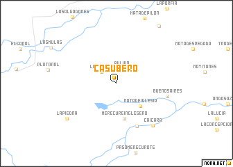
Casubero (Apure, Venezuela)Casubero is a town in the Apure region of Venezuela. An overview map of the region around Casubero is displayed below.
regional and 3d topo map of Casubero, Venezuela ::
Casubero airports ::
The nearest airport is AUC - Arauca Santiago Perez, located 127.8 km west of Casubero.
Other airports nearby include BNS - Barinas (144.1 km north west), GUQ - Guanare (174.8 km north), MRD - Merida Alberto Carnevalli (208.9 km north west), VLV - Valera Dr Antonio Nicolas Briceno (233.3 km north west), Nearby towns ::
Pulido (2.1km north) //
Pulido (2.5km north) //
La Chipola (3.0km north west) //
Mata de Iglesia (5.2km south east) //
Merecure Inglesero (5.7km south) //
Laguna Hermosa (7.6km south east) //
Buenos Aires (8.4km east) //
Caicara (8.9km south east) //
La Piedra (9.7km south west) //
[all distances 'as the bird flies' and approximate] 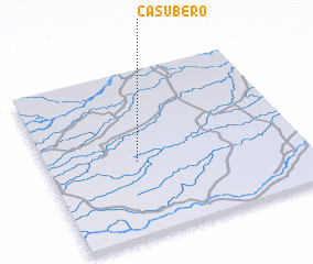 Places with similar names to Casubero, Venezuela ::
// Casiber (PH)
// Casabra (DE)
// Kasbeer (US)
// Kuzah Burah (IQ)
// Kisbér (HU)
// Gazibare (BA)
// Kazbari (LV)
// Kosoy Bor (RU)
// Gooseberry (US)
// Casibari (AW)
Disclaimer :: Information on this page comes without warranty of any kind |
||
|
Where is Casubero? Elevation and coordinates ::
Latitude (lat): 7°27'1"N Longitude (lon): 69°38'41"W
Elevation (approx.): 97m (map arrows pan, magnifying glasses zoom) |
||
|
Visiting Casubero? Hotel/Accommodation ::
Book a hotel in Casubero Travel Guide ::
Buy a travel guide for Venezuela rental cars ::
car rental offers GPS waypoint ::
download a GPX waypoint (PoI) of Casubero for your GPS receiver
|
||