|
search place name
|
||
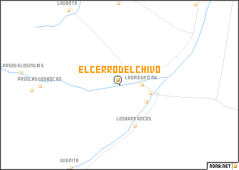
El Cerro Del Chivo (Monagas, Venezuela)El Cerro Del Chivo is a town in the Monagas region of Venezuela. An overview map of the region around El Cerro Del Chivo is displayed below.
regional and 3d topo map of El Cerro Del Chivo, Venezuela ::
El Cerro Del Chivo airports ::
The nearest airport is TUV - Tucupita, located 55.2 km north east of El Cerro Del Chivo.
Other airports nearby include PZO - Guayana General Manuel Carlos Piar (64.4 km south west), MUN - Maturin (124.7 km north west), CBL - Ciudad Bolivar (136.3 km south west), SOM - San Tome (180.5 km west), Nearby towns ::
Las Piedritas (3.5km east) //
Peña Negra (4.9km south east) //
Paso Nuevo (5.0km east) //
Los Barrancos (6.9km south) //
[all distances 'as the bird flies' and approximate]  Places with similar names to El Cerro Del Chivo, Venezuela :: Disclaimer :: Information on this page comes without warranty of any kind |
||
|
Where is El Cerro Del Chivo? Elevation and coordinates ::
Latitude (lat): 8°49'2"N Longitude (lon): 62°30'54"W
Elevation (approx.): 32m (map arrows pan, magnifying glasses zoom) |
||
|
Visiting El Cerro Del Chivo? Hotel/Accommodation ::
Book a hotel in El Cerro Del Chivo Travel Guide ::
Buy a travel guide for Venezuela rental cars ::
car rental offers GPS waypoint ::
download a GPX waypoint (PoI) of El Cerro Del Chivo for your GPS receiver
|
||