|
search place name
|
||
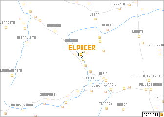
El Pacer (Falcón, Venezuela)El Pacer is a town in the Falcón region of Venezuela. An overview map of the region around El Pacer is displayed below.
regional and 3d topo map of El Pacer, Venezuela ::
El Pacer airports ::
The nearest airport is CZE - Coro Jose Leonardo Chirinos, located 53.6 km north of El Pacer.
Other airports nearby include LSP - Paraguana Josefa Camejo (98.5 km north), BRM - Barquisimeto Intl (112.6 km south east), SFH - San Felipe Sub Teniente Nestor Arias (138.5 km south east), CUR - Willemstad Hato (166.2 km north east), Nearby towns ::
El Placer (0.3km south east) //
El Lindero (1.5km north) //
Santa Lucía (1.7km north east) //
Flor de Aregue (1.9km south east) //
El Porvenir (2.0km north west) //
Paraíso (3.5km south east) //
Bocaina (3.6km north west) //
Las Casitas (5.2km east) //
Los Dos Caminos (5.6km north east) //
Marital (6.0km south) //
Tierra Negra (6.2km north east) //
Nafia (6.7km south east) //
El Jobo (7.4km south east) //
El Yabito (7.5km south) //
Las Burras (7.7km south) //
Juncalito (8.7km north east) //
Guasiquí (8.7km north west) //
San Enrique (9.1km south) //
Balcón (9.3km south east) //
Juan Gil (9.7km south east) //
[all distances 'as the bird flies' and approximate]  Places with similar names to El Pacer, Venezuela :: Disclaimer :: Information on this page comes without warranty of any kind |
||
|
Where is El Pacer? Elevation and coordinates ::
Latitude (lat): 10°57'4"N Longitude (lon): 69°49'22"W
Elevation (approx.): 215m (map arrows pan, magnifying glasses zoom) |
||
|
Visiting El Pacer? Hotel/Accommodation ::
Book a hotel in El Pacer Travel Guide ::
Buy a travel guide for Venezuela rental cars ::
car rental offers GPS waypoint ::
download a GPX waypoint (PoI) of El Pacer for your GPS receiver
|
||