|
search place name
|
||
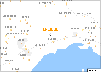
Ereigue (Carabobo, Venezuela)Ereigue is a town in the Carabobo region of Venezuela. An overview map of the region around Ereigue is displayed below.
regional and 3d topo map of Ereigue, Venezuela ::
Ereigue airports ::
The nearest airport is VLN - Valencia Arturo Michelena Intl, located 20.4 km south west of Ereigue.
Other airports nearby include PBL - Puerto Cabello General Bartolome Salom Intl (37.0 km north west), CCS - Caracas Simon Bolivar Intl (95.4 km east), SFH - San Felipe Sub Teniente Nestor Arias (104.6 km west), BRM - Barquisimeto Intl (172.9 km west), Nearby towns ::
San Joaquín (2.5km south) //
Agua Blanca (5.2km east) //
Paraparito (5.5km east) //
Carabalís (5.7km south west) //
El Guamacho (6.7km east) //
Coriano (8.2km north west) //
Virgirimita (8.6km west) //
El Aguacate (9.2km north east) //
Vigirima (9.9km north west) //
Guacara (10.0km south west) //
Las Tunitas (11.9km south west) //
[all distances 'as the bird flies' and approximate] 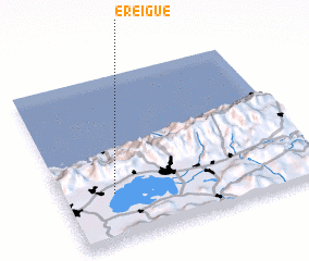 Places with similar names to Ereigue, Venezuela ::
Disclaimer :: Information on this page comes without warranty of any kind |
||
|
Where is Ereigue? Elevation and coordinates ::
Latitude (lat): 10°17'0"N Longitude (lon): 67°48'0"W
Elevation (approx.): 464m (map arrows pan, magnifying glasses zoom) |
||
|
Visiting Ereigue? Hotel/Accommodation ::
Book a hotel in Ereigue Travel Guide ::
Buy a travel guide for Venezuela rental cars ::
car rental offers GPS waypoint ::
download a GPX waypoint (PoI) of Ereigue for your GPS receiver
|
||