|
search place name
|
||
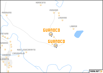
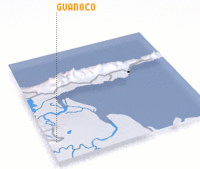
Guanoco (Sucre, Venezuela)Guanoco is a town in the Sucre region of Venezuela. An overview map of the region around Guanoco is displayed below.
regional and 3d topo map of Guanoco, Venezuela ::
Guanoco airports ::
The nearest airport is MUN - Maturin, located 53.1 km south west of Guanoco.
Other airports nearby include CUP - Carupano General Jose Francisco Bermudez (62.3 km north west), GUI - Guiria (82.3 km north east), CUM - Cumana Antonio Jose De Sucre (132.1 km west), PMV - Porlamar Del Caribe Intl Gen Santiago Marino (137.0 km north west), Nearby towns ::
 Places with similar names to Guanoco, Venezuela ::
Disclaimer :: Information on this page comes without warranty of any kind |
||
|
Where is Guanoco? Elevation and coordinates ::
Latitude (lat): 10°11'10"N Longitude (lon): 62°57'14"W
Elevation (approx.): 43m (map arrows pan, magnifying glasses zoom) |
||
|
Visiting Guanoco? Hotel/Accommodation ::
Book a hotel in Guanoco Travel Guide ::
Buy a travel guide for Venezuela rental cars ::
car rental offers GPS waypoint ::
download a GPX waypoint (PoI) of Guanoco for your GPS receiver
|
||