|
search place name
|
||
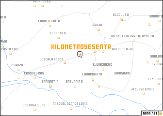
Kilómetro Sesenta (Zulia, Venezuela)Kilómetro Sesenta is a town in the Zulia region of Venezuela. An overview map of the region around Kilómetro Sesenta is displayed below.
regional and 3d topo map of Kilómetro Sesenta, Venezuela ::
Kilómetro Sesenta airports ::
The nearest airport is MAR - Maracaibo La Chinita Intl, located 44.8 km east of Kilómetro Sesenta.
Other airports nearby include VUP - Valledupar Alfonso Lopez Pumarejo (123.7 km west), RCH - Rio Hacha Almirante Padilla (148.9 km north west), STB - Santa Barbara Del Zulia (163.4 km south), VLV - Valera Dr Antonio Nicolas Briceno (207.8 km south east), Nearby towns ::
Santa Rosalía (2.3km north east) //
Kilómetro Cincuenta y seis (3.4km north east) //
La Entrada (3.9km west) //
KilómetroCincuenta y cinco (5.1km east) //
El Dieciocho (5.5km south east) //
La Horqueta (5.6km south east) //
Saturnino (6.7km south) //
Los Calabozos (6.8km west) //
El Centro (6.9km north west) //
Retirada (7.4km south east) //
Paujil (7.6km north east) //
San Pablo (7.6km south east) //
San Martín (9.5km south west) //
La Haciendita (10.4km north west) //
[all distances 'as the bird flies' and approximate] 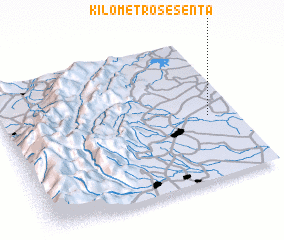 Places with similar names to Kilómetro Sesenta, Venezuela :: Disclaimer :: Information on this page comes without warranty of any kind |
||
|
Where is Kilómetro Sesenta? Elevation and coordinates ::
Latitude (lat): 10°26'30"N Longitude (lon): 72°7'10"W
Elevation (approx.): 72m (map arrows pan, magnifying glasses zoom) |
||
|
Visiting Kilómetro Sesenta? Hotel/Accommodation ::
Book a hotel in Kilómetro Sesenta Travel Guide ::
Buy a travel guide for Venezuela rental cars ::
car rental offers GPS waypoint ::
download a GPX waypoint (PoI) of Kilómetro Sesenta for your GPS receiver
|
||