|
search place name
|
||
La Aguada (Sucre, Venezuela)La Aguada is a town in the Sucre region of Venezuela. An overview map of the region around La Aguada is displayed below.
regional and 3d topo map of La Aguada, Venezuela ::

La Aguada airports ::
The nearest airport is CUM - Cumana Antonio Jose De Sucre, located 18.0 km north of La Aguada.
Other airports nearby include BLA - Barcelona General Jose Antonio Anzoategui Intl (68.3 km west), PMV - Porlamar Del Caribe Intl Gen Santiago Marino (70.1 km north), CUP - Carupano General Jose Francisco Bermudez (99.9 km north east), AAO - Anaco (103.8 km south west), Nearby towns ::
Juan Franco (1.4km north east) //
Campoma (1.6km north) //
Los Portillos (4.6km south west) //
El Chispero (4.7km north east) //
Bajo Seco (4.8km south west) //
Paso Curi (5.0km north) //
El Chispero (5.2km north) //
Sabaneta (5.2km east) //
Brito (5.4km north west) //
Cañifle (5.7km north) //
Colorado (5.8km north) //
Quebrada Grande (5.8km north west) //
Baltasara (6.0km north west) //
La Playita (6.0km north west) //
Agua Santa (6.7km north) //
Munegro (6.7km north) //
Clavellino (6.8km north east) //
Las Majaguas (6.8km north east) //
Pie del Salto (6.9km north west) //
Ranchería (7.1km north east) //
San Agustín (7.2km north west) //
La Vega (7.6km north east) //
Agua Clara (7.7km north) //
Quebrada de Guaranache (7.8km west) //
Cedeño (8.1km north east) //
Barrancas (8.1km north west) //
Salsipuedes (8.2km north east) //
Las Cuevas (8.4km south) //
Monte Oscuro (8.4km south east) //
[all distances 'as the bird flies' and approximate] 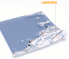 Places with similar names to La Aguada, Venezuela ::
Disclaimer :: Information on this page comes without warranty of any kind |
||
|
Where is La Aguada? Elevation and coordinates ::
Latitude (lat): 10°17'30"N Longitude (lon): 64°5'40"W
Elevation (approx.): 278m (map arrows pan, magnifying glasses zoom) |
||
|
Visiting La Aguada? Hotel/Accommodation ::
Book a hotel in La Aguada Travel Guide ::
Buy a travel guide for Venezuela rental cars ::
car rental offers GPS waypoint ::
download a GPX waypoint (PoI) of La Aguada for your GPS receiver
|
||