|
search place name
|
||
La Aguadita (Barinas, Venezuela)La Aguadita is a town in the Barinas region of Venezuela. An overview map of the region around La Aguadita is displayed below.
regional and 3d topo map of La Aguadita, Venezuela ::

La Aguadita airports ::
The nearest airport is SFD - San Fernando De Apure, located 121.5 km south east of La Aguadita.
Other airports nearby include AGV - Acarigua Oswaldo Guevara Mujica (160.3 km north west), GUQ - Guanare (162.8 km north west), BNS - Barinas (197.5 km west), VLN - Valencia Arturo Michelena Intl (208.9 km north), Nearby towns ::
Guasimito (0.0km north) //
La Guariqueña (3.7km south) //
Santa Lucía (3.7km east) //
Berlín (4.1km north east) //
Las Bonitas (5.2km south east) //
Agua Verde (6.7km north east) //
Maturín (6.7km north east) //
El Sonia (6.6km north east) //
Caujarito (7.4km north) //
La Cruz (7.8km north east) //
El Muerto (8.3km north west) //
Cunaguaro (8.3km north east) //
Flor Amarilla (8.8km east) //
San Vicente (9.2km south west) //
Mapurital (9.2km north east) //
Los Picures (10.4km south east) //
La Providencia (11.6km north west) //
[all distances 'as the bird flies' and approximate] 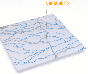 Places with similar names to La Aguadita, Venezuela ::
// Lagatit (PH)
// La Caduta (IT)
// La Aguadita (CU)
// La Aguadita (CO)
// La Aguadita (CO)
// La Aguadita (CO)
// Lokodidi (ID)
// Lokitete (UG)
// Lokudet (UG)
// La Aguadita (VE)
Disclaimer :: Information on this page comes without warranty of any kind |
||
|
Where is La Aguadita? Elevation and coordinates ::
Latitude (lat): 8°20'0"N Longitude (lon): 68°27'0"W
Elevation (approx.): 63m (map arrows pan, magnifying glasses zoom) |
||
|
Visiting La Aguadita? Hotel/Accommodation ::
Book a hotel in La Aguadita Travel Guide ::
Buy a travel guide for Venezuela rental cars ::
car rental offers GPS waypoint ::
download a GPX waypoint (PoI) of La Aguadita for your GPS receiver
|
||