|
search place name
|
||
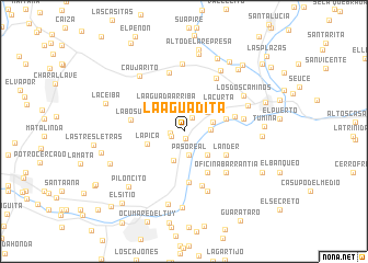
La Aguadita (Miranda, Venezuela)La Aguadita is a town in the Miranda region of Venezuela. An overview map of the region around La Aguadita is displayed below.
regional and 3d topo map of La Aguadita, Venezuela ::
La Aguadita airports ::
The nearest airport is CCS - Caracas Simon Bolivar Intl, located 52.0 km north west of La Aguadita.
Other airports nearby include VLN - Valencia Arturo Michelena Intl (130.5 km west), VDP - Valle De La Pascua (136.0 km south east), PBL - Puerto Cabello General Bartolome Salom Intl (149.3 km west), BON - Kralendijk Flamingo (270.8 km north west), Nearby towns ::
Pararrayos (0.8km south) //
La Vencedora (1.4km west) //
La Aguada del Medio (1.4km west) //
Colonias de San Antonio (1.7km north east) //
El Tigre (2.1km north) //
Paso Real (2.5km south) //
Piñango (2.7km east) //
San Francisco de Yare (3.1km south) //
San Antonio (3.1km east) //
La Pica (3.1km north east) //
La Aguada Arriba (3.3km north west) //
Arratia (3.4km south east) //
La Pica (3.9km west) //
La Curta (4.3km north east) //
El Palmar (4.4km east) //
Los Güires (4.9km south east) //
Lander (4.8km south east) //
Punta Brava (5.2km south) //
El Hornito (5.3km east) //
La Bosúa (5.4km west) //
Tocorón (5.8km south) //
Oficina Barrantia (6.0km south east) //
La Verota (6.2km north) //
La Vencedora (6.2km east) //
Tomuso (6.3km north east) //
Hato Palma (6.5km south) //
El Manguito (6.8km north) //
El Socorro (6.9km east) //
Los Dos Caminos (7.0km north east) //
[all distances 'as the bird flies' and approximate]  Places with similar names to La Aguadita, Venezuela ::
// Lagatit (PH)
// La Caduta (IT)
// La Aguadita (CU)
// La Aguadita (CO)
// La Aguadita (CO)
// La Aguadita (CO)
// Lokodidi (ID)
// Lokitete (UG)
// Lokudet (UG)
// La Aguadita (VE)
Disclaimer :: Information on this page comes without warranty of any kind |
||
|
Where is La Aguadita? Elevation and coordinates ::
Latitude (lat): 10°12'17"N Longitude (lon): 66°44'18"W
Elevation (approx.): 170m (map arrows pan, magnifying glasses zoom) |
||
|
Visiting La Aguadita? Hotel/Accommodation ::
Book a hotel in La Aguadita Travel Guide ::
Buy a travel guide for Venezuela rental cars ::
car rental offers GPS waypoint ::
download a GPX waypoint (PoI) of La Aguadita for your GPS receiver
|
||