|
search place name
|
||
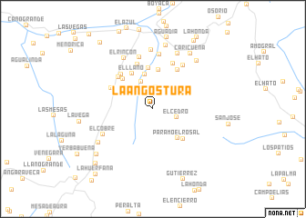
La Angostura (Táchira, Venezuela)La Angostura is a town in the Táchira region of Venezuela. An overview map of the region around La Angostura is displayed below.
regional and 3d topo map of La Angostura, Venezuela ::
La Angostura airports ::
The nearest airport is LFR - La Fria, located 35.4 km north west of La Angostura.
Other airports nearby include SVZ - San Antonio Del Tachira (54.5 km south west), STD - Santo Domingo Mayor Buenaventura Vivas (55.6 km south), CUC - Cucuta Camilo Daza (58.5 km west), STB - Santa Barbara Del Zulia (100.6 km north), Nearby towns ::
El Palenque (2.6km north) //
El Cedro (3.0km east) //
Tadea (3.6km north west) //
San José (4.3km north) //
Páramo El Rosal (4.7km south east) //
Tadea (4.9km north) //
El Llano (5.0km north west) //
Boniquea (5.1km north) //
La Capilla (5.2km north west) //
El Rosal (5.2km south east) //
Babuquena (5.7km north east) //
El Cocal (5.7km north west) //
Bocaquea (5.7km north west) //
Cocubal (5.8km north west) //
Santa Ana (5.8km north) //
Mogotes (6.1km north east) //
Torneadero (6.5km north east) //
El Piñal (6.6km north) //
El Pueblito (6.7km north) //
El Cobre (6.9km south west) //
El Rincón (7.2km north west) //
El Carrizal (7.2km north) //
Agua Caliente (7.4km north east) //
El Molino (7.8km south west) //
Palmero (7.9km north east) //
La Grita (8.0km north) //
Caricuena (8.2km north east) //
El Llanito (8.8km south west) //
Aguadía (8.9km north) //
[all distances 'as the bird flies' and approximate] 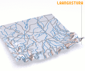 Places with similar names to La Angostura, Venezuela ::
// Lancaster (US)
// Lancaster (US)
// Lancaster (US)
// Lancaster (US)
// Lancaster (US)
// Lancaster (US)
// Lancaster (US)
// Lancaster (US)
// La Angostura (PA)
// La Angostura (PA)
Disclaimer :: Information on this page comes without warranty of any kind |
||
|
Where is La Angostura? Elevation and coordinates ::
Latitude (lat): 8°4'0"N Longitude (lon): 72°0'0"W
Elevation (approx.): 2269m (map arrows pan, magnifying glasses zoom) |
||
|
Visiting La Angostura? Hotel/Accommodation ::
Book a hotel in La Angostura Travel Guide ::
Buy a travel guide for Venezuela rental cars ::
car rental offers GPS waypoint ::
download a GPX waypoint (PoI) of La Angostura for your GPS receiver
|
||