|
search place name
|
||
La Chivera (Cojedes, Venezuela)La Chivera is a town in the Cojedes region of Venezuela. An overview map of the region around La Chivera is displayed below.
regional and 3d topo map of La Chivera, Venezuela ::

La Chivera airports ::
The nearest airport is AGV - Acarigua Oswaldo Guevara Mujica, located 59.5 km west of La Chivera.
Other airports nearby include SFH - San Felipe Sub Teniente Nestor Arias (88.2 km north), BRM - Barquisimeto Intl (95.1 km north west), VLN - Valencia Arturo Michelena Intl (112.2 km north east), GUQ - Guanare (126.5 km south west), Nearby towns ::
Campo Alegre (1.9km south) //
Caño Hondo (1.9km south) //
La Palenciera (2.6km south west) //
Buenos Aires (2.6km north east) //
La Chepera (3.7km south) //
Barreto (4.1km south west) //
Ojo de Agua (4.8km north) //
El Muertico (5.9km south) //
La Vigía (6.0km east) //
El Muertico (6.1km south) //
Mata del Medio (6.7km south west) //
El Toro (6.7km south east) //
Chupadal (7.1km north) //
Quintanero (7.6km south) //
El Pajón (7.6km south) //
Lomo Perro (7.6km south) //
La Vega (7.8km north east) //
Palo Quemado (8.3km south west) //
El Estero (8.6km south west) //
El Yagual (11.5km north east) //
Mata Oscura (12.2km north west) //
[all distances 'as the bird flies' and approximate] 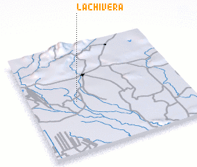 Places with similar names to La Chivera, Venezuela ::
// Lochifor (SD)
// La Chivera (VE)
// La Chivera (VE)
// La Chivera (VE)
// La Chivera (VE)
// La Chivera (VE)
// La Chivera (VE)
// Lucía Vera (VE)
// Luchafer (MD)
// La Chauvière (FR)
Disclaimer :: Information on this page comes without warranty of any kind |
||
|
Where is La Chivera? Elevation and coordinates ::
Latitude (lat): 9°29'0"N Longitude (lon): 68°42'0"W
Elevation (approx.): 117m (map arrows pan, magnifying glasses zoom) |
||
|
Visiting La Chivera? Hotel/Accommodation ::
Book a hotel in La Chivera Travel Guide ::
Buy a travel guide for Venezuela rental cars ::
car rental offers GPS waypoint ::
download a GPX waypoint (PoI) of La Chivera for your GPS receiver
|
||