|
search place name
|
||
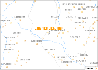
La Encrucijada (Lara, Venezuela)La Encrucijada is a town in the Lara region of Venezuela. An overview map of the region around La Encrucijada is displayed below.
regional and 3d topo map of La Encrucijada, Venezuela ::
La Encrucijada airports ::
The nearest airport is VLV - Valera Dr Antonio Nicolas Briceno, located 100.9 km south of La Encrucijada.
Other airports nearby include BRM - Barquisimeto Intl (128.9 km east), MAR - Maracaibo La Chinita Intl (137.0 km west), CZE - Coro Jose Leonardo Chirinos (157.8 km north east), GUQ - Guanare (159.0 km south east), Nearby towns ::
Quebrada Arriba (2.4km south west) //
Cieneguita (3.3km east) //
Paso Sabaneta (3.7km east) //
Sabaneta (5.4km east) //
El Paramito (5.7km south west) //
La Llora (6.4km north east) //
Los Altares (6.6km south) //
Las Palomas (7.3km east) //
Rincón Hondo (7.7km south) //
Sabana de Onoto (8.7km south) //
La Azulita (10.2km north east) //
La Mora (11.5km north east) //
[all distances 'as the bird flies' and approximate] 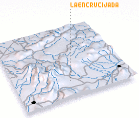 Places with similar names to La Encrucijada, Venezuela ::
// La Encrucijada (CU)
// La Encrucijada (CU)
// La Encrucijada (EC)
// La Encrucijada (MX)
// La Encruciijada (VE)
// La Encrucijada (VE)
// La Encrucijada (VE)
// La Encrucijada (VE)
// La Encrucijada (VE)
// La Encrucijada (VE)
Disclaimer :: Information on this page comes without warranty of any kind |
||
|
Where is La Encrucijada? Elevation and coordinates ::
Latitude (lat): 10°15'2"N Longitude (lon): 70°30'56"W
Elevation (approx.): 558m (map arrows pan, magnifying glasses zoom) |
||
|
Visiting La Encrucijada? Hotel/Accommodation ::
Book a hotel in La Encrucijada Travel Guide ::
Buy a travel guide for Venezuela rental cars ::
car rental offers GPS waypoint ::
download a GPX waypoint (PoI) of La Encrucijada for your GPS receiver
|
||