|
search place name
|
||
La Gran Parada (Trujillo, Venezuela)La Gran Parada is a town in the Trujillo region of Venezuela. An overview map of the region around La Gran Parada is displayed below.
regional and 3d topo map of La Gran Parada, Venezuela ::

La Gran Parada airports ::
The nearest airport is VLV - Valera Dr Antonio Nicolas Briceno, located 44.8 km south of La Gran Parada.
Other airports nearby include GUQ - Guanare (109.7 km south east), BNS - Barinas (125.4 km south), BRM - Barquisimeto Intl (126.0 km east), AGV - Acarigua Oswaldo Guevara Mujica (135.8 km east), Nearby towns ::
El Corozal (2.1km south) //
Las Playitas (2.2km east) //
San Antonio (2.8km east) //
Las Tres Matas (3.4km north west) //
Chaparrote (3.4km north east) //
San Felipe (4.6km south east) //
El Batatillo (5.6km north east) //
Santa Rosa (6.0km south east) //
San Isidro (6.1km north east) //
El Paramito (6.4km south east) //
Sabana Grande (7.2km west) //
Zapatero (7.8km south east) //
Las Escobas (9.3km north east) //
La Urbina (9.5km south west) //
Los Cardones (9.6km south west) //
Santa Cruz (9.8km south east) //
Santa Cruz (11.2km south east) //
[all distances 'as the bird flies' and approximate] 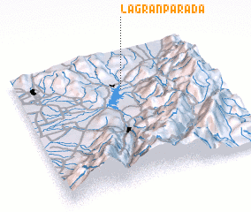 Places with similar names to La Gran Parada, Venezuela ::
// La Gran Parada (VE)
// La Gran Parada (VE)
// La Gran Parada (VE)
// La Gran Parada (DO)
// La Gran Parada (DO)
// La Gran Parada (DO)
Disclaimer :: Information on this page comes without warranty of any kind |
||
|
Where is La Gran Parada? Elevation and coordinates ::
Latitude (lat): 9°43'40"N Longitude (lon): 70°27'44"W
Elevation (approx.): 250m (map arrows pan, magnifying glasses zoom) |
||
|
Visiting La Gran Parada? Hotel/Accommodation ::
Book a hotel in La Gran Parada Travel Guide ::
Buy a travel guide for Venezuela rental cars ::
car rental offers GPS waypoint ::
download a GPX waypoint (PoI) of La Gran Parada for your GPS receiver
|
||