|
search place name
|
||
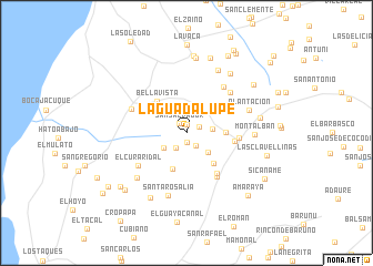
La Guadalupe (Falcón, Venezuela)La Guadalupe is a town in the Falcón region of Venezuela. An overview map of the region around La Guadalupe is displayed below.
regional and 3d topo map of La Guadalupe, Venezuela ::
La Guadalupe airports ::
The nearest airport is LSP - Paraguana Josefa Camejo, located 18.6 km south of La Guadalupe.
Other airports nearby include AUA - Oranjestad Reina Beatrix Intl (62.5 km north), CZE - Coro Jose Leonardo Chirinos (76.0 km south east), CUR - Willemstad Hato (129.5 km east), BON - Kralendijk Flamingo (203.0 km east), Nearby towns ::
San Pedro (0.8km north) //
Iticuna (0.9km south) //
San Salvador (1.2km north west) //
Tinaquillo (1.3km north east) //
Las Margaritas (1.6km south east) //
Belatoz (1.8km south west) //
El Isiro (2.6km east) //
San Fernando (2.7km south west) //
San Andres (2.9km south east) //
El Carmelo (3.9km south) //
Sabaneta (3.9km east) //
Tabe (4.1km south east) //
Bella Vista (4.3km north west) //
San Vicente (4.9km east) //
San Enrique (5.1km south east) //
El Socorro (5.2km east) //
Jadacaquiva (5.4km south east) //
El Curaridal (5.8km south west) //
Isito (5.9km north east) //
Jacuque (5.9km north west) //
La Florida (6.0km north east) //
Santa Rosalía (6.6km south) //
Plantación (6.6km east) //
Valle Verde (6.6km south west) //
Montalbán (6.7km east) //
Sabaneta Escondida (7.1km north east) //
Piedras Negras (7.4km north east) //
Sabana Grande (7.5km south west) //
San José de Acaboa (7.6km north) //
[all distances 'as the bird flies' and approximate]  Places with similar names to La Guadalupe, Venezuela ::
// La Guadalupe (PA)
// La Guadalupe (CU)
// La Guadalupe (CO)
// La Guadalupe (MX)
// La Guadalupe (MX)
// La Guadalupe (MX)
// La Guadalupe (HN)
// La Guadalupe (HN)
// La Guadalupe (HN)
// La Guadalupe (HN)
Disclaimer :: Information on this page comes without warranty of any kind |
||
|
Where is La Guadalupe? Elevation and coordinates ::
Latitude (lat): 11°56'47"N Longitude (lon): 70°7'24"W
Elevation (approx.): 50m (map arrows pan, magnifying glasses zoom) |
||
|
Visiting La Guadalupe? Hotel/Accommodation ::
Book a hotel in La Guadalupe Travel Guide ::
Buy a travel guide for Venezuela rental cars ::
car rental offers GPS waypoint ::
download a GPX waypoint (PoI) of La Guadalupe for your GPS receiver
|
||