|
search place name
|
||
La Hormiga (Monagas, Venezuela)La Hormiga is a town in the Monagas region of Venezuela. An overview map of the region around La Hormiga is displayed below.
regional and 3d topo map of La Hormiga, Venezuela ::

La Hormiga airports ::
The nearest airport is MUN - Maturin, located 23.0 km south west of La Hormiga.
Other airports nearby include CUP - Carupano General Jose Francisco Bermudez (92.4 km north), GUI - Guiria (107.0 km north east), TUV - Tucupita (130.5 km south east), CUM - Cumana Antonio Jose De Sucre (141.0 km north west), Nearby towns ::
La Yagua (0.4km west) //
Quebrada Honda (3.4km south west) //
La Esperanza (4.9km south) //
Guarauno (6.3km south west) //
Vuelta Larga (6.6km south west) //
La Locación (6.7km south west) //
Guamito (7.9km north west) //
Caño Colorado (8.6km north east) //
Cañito (9.0km south west) //
Joropo (10.5km south west) //
[all distances 'as the bird flies' and approximate] 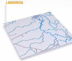 Places with similar names to La Hormiga, Venezuela ::
// La Hormiga (CU)
// La Hormiga (MX)
// La Hormiga (MX)
// La Hormiga (VE)
// La Hormiga (VE)
// La Hormiga (VE)
// La Hormiga (VE)
// La Hormiga (VE)
// La Hormiga (NI)
// La Hormiga (BO)
Disclaimer :: Information on this page comes without warranty of any kind |
||
|
Where is La Hormiga? Elevation and coordinates ::
Latitude (lat): 9°52'16"N Longitude (lon): 62°59'3"W
Elevation (approx.): 20m (map arrows pan, magnifying glasses zoom) |
||
|
Visiting La Hormiga? Hotel/Accommodation ::
Book a hotel in La Hormiga Travel Guide ::
Buy a travel guide for Venezuela rental cars ::
car rental offers GPS waypoint ::
download a GPX waypoint (PoI) of La Hormiga for your GPS receiver
|
||