|
search place name
|
||
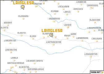
La Inglesa (Monagas, Venezuela)La Inglesa is a town in the Monagas region of Venezuela. An overview map of the region around La Inglesa is displayed below.
regional and 3d topo map of La Inglesa, Venezuela ::
La Inglesa airports ::
The nearest airport is MUN - Maturin, located 69.1 km north east of La Inglesa.
Other airports nearby include SOM - San Tome (79.3 km west), AAO - Anaco (111.0 km west), CBL - Ciudad Bolivar (121.2 km south), PZO - Guayana General Manuel Carlos Piar (129.9 km south east), Nearby towns ::
San José del Ñato (1.3km east) //
El Maitero (1.5km west) //
Las Terecayas (2.7km south) //
LasTerecayas (2.8km south) //
Las Palmeras (2.9km west) //
Pavón (5.5km east) //
Vaquereño (5.6km north) //
Vaquereño (5.7km north) //
La Vigía (6.6km north east) //
El Oso (6.9km west) //
La Vigía (6.9km north east) //
Girón (7.6km east) //
El Paso (8.5km north) //
La Pica (9.8km north east) //
[all distances 'as the bird flies' and approximate] 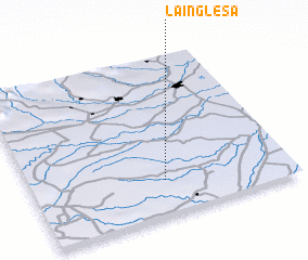 Places with similar names to La Inglesa, Venezuela ::
Disclaimer :: Information on this page comes without warranty of any kind |
||
|
Where is La Inglesa? Elevation and coordinates ::
Latitude (lat): 9°13'0"N Longitude (lon): 63°29'0"W
Elevation (approx.): 147m (map arrows pan, magnifying glasses zoom) |
||
|
Visiting La Inglesa? Hotel/Accommodation ::
Book a hotel in La Inglesa Travel Guide ::
Buy a travel guide for Venezuela rental cars ::
car rental offers GPS waypoint ::
download a GPX waypoint (PoI) of La Inglesa for your GPS receiver
|
||