|
search place name
|
||
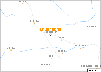
Laja Negra (Bolívar, Venezuela)Laja Negra is a town in the Bolívar region of Venezuela. An overview map of the region around Laja Negra is displayed below.
regional and 3d topo map of Laja Negra, Venezuela ::
Laja Negra airports ::
The nearest airport is CBL - Ciudad Bolivar, located 63.2 km north of Laja Negra.
Other airports nearby include PZO - Guayana General Manuel Carlos Piar (109.9 km north east), CAJ - Canaima (160.3 km south east), SOM - San Tome (172.3 km north west), TUV - Tucupita (224.8 km north east), Nearby towns ::
La Arenosa (0.7km north east) //
Yauno (4.3km east) //
Grimaldi (7.7km south east) //
San Andrés (7.8km north west) //
Gómez (8.4km south) //
[all distances 'as the bird flies' and approximate] 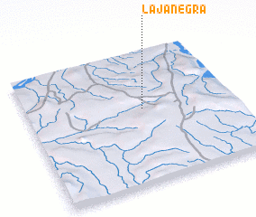 Places with similar names to Laja Negra, Venezuela ::
// La Juncar (ES)
// La Junquera (ES)
// La Junquera (ES)
// Laja Negra (VE)
// Laja Negra (VE)
// La Junquera (ES)
// Løjenkær (DK)
// La Jonquière (FR)
Disclaimer :: Information on this page comes without warranty of any kind |
||
|
Where is Laja Negra? Elevation and coordinates ::
Latitude (lat): 7°33'32"N Longitude (lon): 63°26'14"W
Elevation (approx.): 205m (map arrows pan, magnifying glasses zoom) |
||
|
Visiting Laja Negra? Hotel/Accommodation ::
Book a hotel in Laja Negra Travel Guide ::
Buy a travel guide for Venezuela rental cars ::
car rental offers GPS waypoint ::
download a GPX waypoint (PoI) of Laja Negra for your GPS receiver
|
||