|
search place name
|
||
La Llanada (Falcón, Venezuela)La Llanada is a town in the Falcón region of Venezuela. An overview map of the region around La Llanada is displayed below.
regional and 3d topo map of La Llanada, Venezuela ::

La Llanada airports ::
The nearest airport is CZE - Coro Jose Leonardo Chirinos, located 40.7 km west of La Llanada.
Other airports nearby include CUR - Willemstad Hato (93.0 km north east), LSP - Paraguana Josefa Camejo (100.1 km north west), BON - Kralendijk Flamingo (137.9 km north east), SFH - San Felipe Sub Teniente Nestor Arias (140.2 km south east), Nearby towns ::
San Rafael (1.4km north) //
Mampostal (1.6km north east) //
San Vicente (2.9km north) //
Montaña de Los Indios (3.0km north) //
San Nicolás (3.0km north) //
La Trinidad (3.0km west) //
Cumarebito (3.3km north) //
La Peñita (3.7km north west) //
Quiriguá (3.9km north west) //
Acurigüita (4.1km south) //
San Juan (4.1km east) //
Pueblo Cumarebo (4.2km north) //
San Pablo (4.6km north) //
Cerro Agua Blanca (4.8km north) //
Santa Cruz (4.9km north east) //
Curumiana (5.1km north) //
Campo Creole (5.4km north) //
San Francisco (5.6km north east) //
La Ciénega (5.6km north east) //
Montes de Acurigüita (6.0km south west) //
San Pedro (6.1km north west) //
Juan Díaz (6.2km south east) //
Campo Caquetio (6.5km north) //
Cerro El Veral (6.5km north) //
Colina (6.7km north west) //
Turupia (6.8km north east) //
Soledad Arriba (6.8km west) //
Monte Oscuro (6.9km north) //
La Providencia (6.9km north) //
[all distances 'as the bird flies' and approximate] 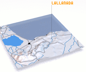 Places with similar names to La Llanada, Venezuela ::
// Lalenta (ER)
// Leland (US)
// Leland (US)
// Leland (US)
// Leland (US)
// Leland (US)
// Leland (US)
// La Llanita (PA)
// La Llanita (PA)
// Leilland (NO)
Disclaimer :: Information on this page comes without warranty of any kind |
||
|
Where is La Llanada? Elevation and coordinates ::
Latitude (lat): 11°25'18"N Longitude (lon): 69°18'32"W
Elevation (approx.): 110m (map arrows pan, magnifying glasses zoom) |
||
|
Visiting La Llanada? Hotel/Accommodation ::
Book a hotel in La Llanada Travel Guide ::
Buy a travel guide for Venezuela rental cars ::
car rental offers GPS waypoint ::
download a GPX waypoint (PoI) of La Llanada for your GPS receiver
|
||