|
search place name
|
||
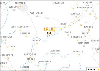
La Luz (Venezuela)La Luz is a town in Venezuela. An overview map of the region around La Luz is displayed below.
regional and 3d topo map of La Luz, Venezuela ::
La Luz airports ::
The nearest airport is VLV - Valera Dr Antonio Nicolas Briceno, located 76.2 km south of La Luz.
Other airports nearby include MAR - Maracaibo La Chinita Intl (116.8 km north west), GUQ - Guanare (158.8 km south east), MRD - Merida Alberto Carnevalli (159.1 km south), BRM - Barquisimeto Intl (161.8 km east), Nearby towns ::
Matajey (2.1km east) //
Mataley (2.2km north east) //
Morroco (4.6km north east) //
Guasimal (5.7km south west) //
Misón (6.3km north east) //
Misoa (6.3km north east) //
Riecito (6.6km east) //
La Esperanza (7.0km north) //
Los Caobos (7.2km south) //
Misoa (8.2km north east) //
Puente Palma (8.9km north west) //
Puente Palma (8.9km north west) //
El Venadito (9.6km north east) //
Las Cotizas (10.9km south west) //
[all distances 'as the bird flies' and approximate] 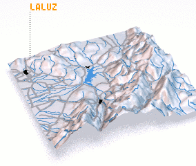 Places with similar names to La Luz, Venezuela ::
Disclaimer :: Information on this page comes without warranty of any kind |
||
|
Where is La Luz? Elevation and coordinates ::
Latitude (lat): 9°59'0"N Longitude (lon): 70°50'0"W
Elevation (approx.): 204m (map arrows pan, magnifying glasses zoom) |
||
|
Visiting La Luz? Hotel/Accommodation ::
Book a hotel in La Luz Travel Guide ::
Buy a travel guide for Venezuela rental cars ::
car rental offers GPS waypoint ::
download a GPX waypoint (PoI) of La Luz for your GPS receiver
|
||