|
search place name
|
||
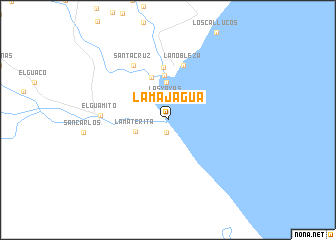
La Majagua (Zulia, Venezuela)La Majagua is a town in the Zulia region of Venezuela. An overview map of the region around La Majagua is displayed below.
regional and 3d topo map of La Majagua, Venezuela ::
La Majagua airports ::
The nearest airport is STB - Santa Barbara Del Zulia, located 92.8 km south of La Majagua.
Other airports nearby include MAR - Maracaibo La Chinita Intl (94.5 km north east), VUP - Valledupar Alfonso Lopez Pumarejo (143.0 km north west), MRD - Merida Alberto Carnevalli (170.3 km south east), LFR - La Fria (173.0 km south), Nearby towns ::
El Guaco (0.5km north) //
La Caleta (1.4km south) //
Las Yayas (2.4km north) //
Guamo (3.1km north west) //
La Materita (3.8km west) //
La Quiracha (4.2km north) //
Caño Hondo (5.0km north) //
El Consuelo (5.1km north) //
Sabanitas (5.8km north) //
La Nobleza (6.3km north) //
Santa Cruz (7.1km north west) //
El Guamito (7.4km west) //
[all distances 'as the bird flies' and approximate] 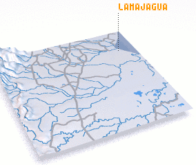 Places with similar names to La Majagua, Venezuela ::
// La Majagua (CU)
// La Majagua (CU)
// La Majagua (CU)
// La Majagua (CU)
// La Majagua (CU)
// La Majagua (CU)
// La Majagua (CU)
// La Majagua (CU)
// La Majagua (CU)
// La Majagua (MX)
Disclaimer :: Information on this page comes without warranty of any kind |
||
|
Where is La Majagua? Elevation and coordinates ::
Latitude (lat): 9°47'44"N Longitude (lon): 72°6'56"W
Elevation (approx.): -32768m (map arrows pan, magnifying glasses zoom) |
||
|
Visiting La Majagua? Hotel/Accommodation ::
Book a hotel in La Majagua Travel Guide ::
Buy a travel guide for Venezuela rental cars ::
car rental offers GPS waypoint ::
download a GPX waypoint (PoI) of La Majagua for your GPS receiver
|
||