|
search place name
|
||
La Realidad (Barinas, Venezuela)La Realidad is a town in the Barinas region of Venezuela. An overview map of the region around La Realidad is displayed below.
regional and 3d topo map of La Realidad, Venezuela ::
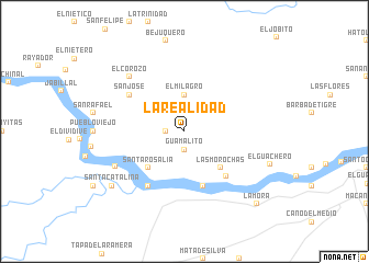
La Realidad airports ::
The nearest airport is SFD - San Fernando De Apure, located 155.2 km east of La Realidad.
Other airports nearby include GUQ - Guanare (155.3 km north west), BNS - Barinas (168.2 km north west), AGV - Acarigua Oswaldo Guevara Mujica (182.4 km north), AUC - Arauca Santiago Perez (229.9 km south west), Nearby towns ::
Guamalito (1.9km south) //
La Reforma (1.8km west) //
El Milagro (3.7km north) //
Las Morochas (5.2km south east) //
Santa Rosalía (5.2km south west) //
La Providencia (5.9km south) //
Las Mulas (6.3km south east) //
Manguitos (6.7km south west) //
San José (6.6km north west) //
África (7.8km south west) //
El Corozo (7.8km north west) //
Santa Catalina (9.2km south west) //
El Guachero (9.3km east) //
La Mora (10.4km south east) //
[all distances 'as the bird flies' and approximate] 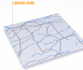 Places with similar names to La Realidad, Venezuela ::
Disclaimer :: Information on this page comes without warranty of any kind |
||
|
Where is La Realidad? Elevation and coordinates ::
Latitude (lat): 7°57'0"N Longitude (lon): 68°51'0"W
Elevation (approx.): 72m (map arrows pan, magnifying glasses zoom) |
||
|
Visiting La Realidad? Hotel/Accommodation ::
Book a hotel in La Realidad Travel Guide ::
Buy a travel guide for Venezuela rental cars ::
car rental offers GPS waypoint ::
download a GPX waypoint (PoI) of La Realidad for your GPS receiver
|
||