|
search place name
|
||
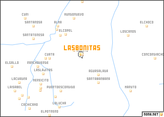
Las Bonitas (Bolívar, Venezuela)Las Bonitas is a town in the Bolívar region of Venezuela. An overview map of the region around Las Bonitas is displayed below.
regional and 3d topo map of Las Bonitas, Venezuela ::
Las Bonitas airports ::
The nearest airport is PZO - Guayana General Manuel Carlos Piar, located 138.5 km north west of Las Bonitas.
Other airports nearby include CAJ - Canaima (139.8 km south west), CBL - Ciudad Bolivar (188.1 km north west), TUV - Tucupita (205.2 km north), Nearby towns ::
Maruto (0.9km north) //
Cachicamo (2.6km north west) //
La Laja (2.8km north west) //
Agua Salada (5.2km south east) //
Santa Bárbara (6.7km south east) //
El Copel (6.7km north west) //
Carutal (7.2km north west) //
Cuata (7.4km west) //
Agua Clara (8.3km west) //
La Flor (8.8km north west) //
Puerto Escondido (8.8km south west) //
Alma (9.2km north west) //
Las Lajitas (9.5km west) //
Las Corobas (10.6km south west) //
[all distances 'as the bird flies' and approximate] 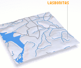 Places with similar names to Las Bonitas, Venezuela ::
// Las Benitas (PA)
// Las Bonitas (CO)
// Las Bonitas (CO)
// Les Bandas (CG)
// Los Bonetes (MX)
// Las Bonitas (HN)
// Las Sabanetas (HN)
// Las Sabanitas (HN)
// Las Bonitas (VE)
// Las Bonitas (VE)
Disclaimer :: Information on this page comes without warranty of any kind |
||
|
Where is Las Bonitas? Elevation and coordinates ::
Latitude (lat): 7°14'0"N Longitude (lon): 62°5'0"W
Elevation (approx.): 211m (map arrows pan, magnifying glasses zoom) |
||
|
Visiting Las Bonitas? Hotel/Accommodation ::
Book a hotel in Las Bonitas Travel Guide ::
Buy a travel guide for Venezuela rental cars ::
car rental offers GPS waypoint ::
download a GPX waypoint (PoI) of Las Bonitas for your GPS receiver
|
||