|
search place name
|
||
Las Piguas (Lara, Venezuela)Las Piguas is a town in the Lara region of Venezuela. An overview map of the region around Las Piguas is displayed below.
regional and 3d topo map of Las Piguas, Venezuela ::

Las Piguas airports ::
The nearest airport is VLV - Valera Dr Antonio Nicolas Briceno, located 49.6 km south of Las Piguas.
Other airports nearby include GUQ - Guanare (129.2 km south east), BNS - Barinas (137.2 km south), MRD - Merida Alberto Carnevalli (144.2 km south west), BRM - Barquisimeto Intl (144.7 km east), Nearby towns ::
El Secreto (1.7km south) //
Río Chiquito (1.9km east) //
La Unión (2.6km north) //
Buenos Aires (4.1km south east) //
El Paradero (4.5km east) //
Caño de León (4.6km south east) //
La Placita (5.7km south east) //
La Chacota (6.7km east) //
Los Caprichos (7.0km north) //
Loma Seca (8.0km north) //
Cachicamo (10.1km south east) //
[all distances 'as the bird flies' and approximate] 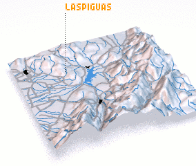 Places with similar names to Las Piguas, Venezuela ::
// Les Pâquis (CH)
// Los Pugas (PA)
// Los Puquios (CL)
// Las Pacas (MX)
// Las Pacas (MX)
// Los Puquios (PE)
// Los Puquios (PE)
// Les Pieux (FR)
// Los Puquios (BO)
// Los Puquios (BO)
Disclaimer :: Information on this page comes without warranty of any kind |
||
|
Where is Las Piguas? Elevation and coordinates ::
Latitude (lat): 9°47'2"N Longitude (lon): 70°39'6"W
Elevation (approx.): 500m (map arrows pan, magnifying glasses zoom) |
||
|
Visiting Las Piguas? Hotel/Accommodation ::
Book a hotel in Las Piguas Travel Guide ::
Buy a travel guide for Venezuela rental cars ::
car rental offers GPS waypoint ::
download a GPX waypoint (PoI) of Las Piguas for your GPS receiver
|
||