|
search place name
|
||
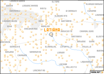
La Tiama (Miranda, Venezuela)La Tiama is a town in the Miranda region of Venezuela. An overview map of the region around La Tiama is displayed below.
regional and 3d topo map of La Tiama, Venezuela ::
La Tiama airports ::
The nearest airport is CCS - Caracas Simon Bolivar Intl, located 31.7 km north west of La Tiama.
Other airports nearby include VLN - Valencia Arturo Michelena Intl (131.1 km west), PBL - Puerto Cabello General Bartolome Salom Intl (143.5 km west), VDP - Valle De La Pascua (157.6 km south east), SFH - San Felipe Sub Teniente Nestor Arias (218.7 km west), Nearby towns ::
Lira (1.0km north) //
Barlovento (1.0km north) //
Catacaguana (1.3km south) //
Los Mariches (1.6km east) //
El Rosario (1.8km north east) //
La Estrella (2.2km north east) //
Cerro Grande (2.3km north west) //
La Concha (2.6km south west) //
Guayabito (2.6km north east) //
Suárez (2.8km north) //
Esperanza (3.0km north) //
Sabaneta Abajo (3.0km south west) //
Tusmare (3.0km south west) //
Mi Chiquita (3.1km west) //
El Mamón (3.2km south east) //
Urbanización Valle Fresco (3.3km north east) //
Guanasmita (3.3km north) //
El Encantado (3.5km north west) //
Los Naranjos (3.5km north west) //
Papelón (3.5km north west) //
La Vega (3.5km east) //
La Oscurana (3.5km east) //
Los Mariones (3.5km east) //
El Latón (3.5km east) //
Padrón (3.5km east) //
San José de Lira (3.9km north east) //
La Estrella (4.1km west) //
La Cabaña (4.1km west) //
La Pollera (4.1km west) //
[all distances 'as the bird flies' and approximate] 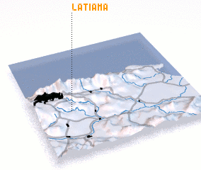 Places with similar names to La Tiama, Venezuela ::
Disclaimer :: Information on this page comes without warranty of any kind |
||
|
Where is La Tiama? Elevation and coordinates ::
Latitude (lat): 10°25'30"N Longitude (lon): 66°45'50"W
Elevation (approx.): 706m (map arrows pan, magnifying glasses zoom) |
||
|
Visiting La Tiama? Hotel/Accommodation ::
Book a hotel in La Tiama Travel Guide ::
Buy a travel guide for Venezuela rental cars ::
car rental offers GPS waypoint ::
download a GPX waypoint (PoI) of La Tiama for your GPS receiver
|
||