|
search place name
|
||
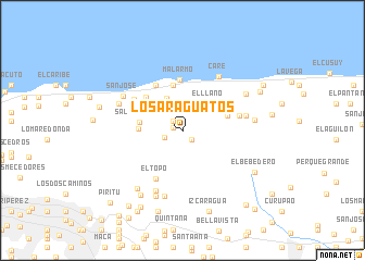
Los Araguatos (Estado Vargas, Venezuela)Los Araguatos is a town in the Estado Vargas region of Venezuela. An overview map of the region around Los Araguatos is displayed below.
regional and 3d topo map of Los Araguatos, Venezuela ::
Los Araguatos airports ::
The nearest airport is CCS - Caracas Simon Bolivar Intl, located 29.2 km west of Los Araguatos.
Other airports nearby include VLN - Valencia Arturo Michelena Intl (139.9 km west), PBL - Puerto Cabello General Bartolome Salom Intl (147.9 km west), VDP - Valle De La Pascua (169.8 km south east), BON - Kralendijk Flamingo (240.9 km north west), Nearby towns ::
La Planicie (1.0km west) //
Oficina Miguel Arenas (1.3km south east) //
Oficina Alvarenga (1.3km north west) //
La Chocha (2.0km west) //
Piedra de Moler (2.9km north) //
La Planta (3.7km north west) //
El Llano (3.9km north east) //
Filadelfia (4.4km west) //
Salto de Uria (4.4km west) //
Naiguatá (4.7km north) //
Los Italianos (4.7km north) //
Hacienda Longa (4.7km north) //
María Isabel (4.8km east) //
El Corozo (5.0km north west) //
Malarmo (5.2km north) //
La Montaña (5.4km north west) //
El Puerto (5.4km north west) //
El Topo (5.7km south west) //
El Zapatero (5.9km north west) //
El Naranjal (5.9km east) //
La Cortada (6.5km east) //
Care (6.6km north east) //
La Cortada (6.8km south west) //
San José (6.9km north west) //
Culebrillas (7.0km south) //
Carmen de Uria (7.0km north west) //
El Deleite (7.3km south) //
La Haciendita (7.4km north east) //
Macanillal (7.4km east) //
[all distances 'as the bird flies' and approximate] 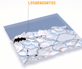 Places with similar names to Los Araguatos, Venezuela ::
// Los Regadíos (GT)
// Los Regadíos (GT)
// Los Arquitos (MX)
// Los Arquitos (MX)
// Los Arquitos (MX)
// Los Arquitos (MX)
// Los Arquitos (MX)
// Los Surquitos (HN)
// Las Araguatas (VE)
// Los Araguatos (VE)
Disclaimer :: Information on this page comes without warranty of any kind |
||
|
Where is Los Araguatos? Elevation and coordinates ::
Latitude (lat): 10°34'30"N Longitude (lon): 66°43'30"W
Elevation (approx.): 1014m (map arrows pan, magnifying glasses zoom) |
||
|
Visiting Los Araguatos? Hotel/Accommodation ::
Book a hotel in Los Araguatos Travel Guide ::
Buy a travel guide for Venezuela rental cars ::
car rental offers GPS waypoint ::
download a GPX waypoint (PoI) of Los Araguatos for your GPS receiver
|
||