|
search place name
|
||
Los Laureles (Táchira, Venezuela)Los Laureles is a town in the Táchira region of Venezuela. An overview map of the region around Los Laureles is displayed below.
regional and 3d topo map of Los Laureles, Venezuela ::

Los Laureles airports ::
The nearest airport is LFR - La Fria, located 55.9 km west of Los Laureles.
Other airports nearby include STD - Santo Domingo Mayor Buenaventura Vivas (64.2 km south west), SVZ - San Antonio Del Tachira (77.1 km west), CUC - Cucuta Camilo Daza (82.0 km west), MRD - Merida Alberto Carnevalli (87.8 km north east), Nearby towns ::
Mesa Bustamante (0.5km south east) //
Laguna del Socorro (1.8km south) //
El Alto (3.1km south) //
Mesa de Moreno (3.2km north east) //
Páramo de Pérez (3.2km south west) //
Pozo Azul (3.4km south east) //
La Travesía (3.6km south east) //
Las Aguadas (4.5km south west) //
Michitud (4.5km east) //
Montaña Alta (4.9km south) //
Montaña Alta (5.1km south) //
Saisayal (5.6km south west) //
Temblador (5.6km west) //
Río Blanco (5.7km east) //
Temblador (5.9km west) //
Loma Larga (6.2km south east) //
La Amarilla (6.4km west) //
Montaña Baja (6.6km south) //
La Batea (6.9km south) //
Huesca (7.1km north east) //
Loma Redonda (7.2km north) //
San José (7.2km south) //
Boca de Monte (7.5km south west) //
Pregonero (7.6km south) //
Mesa Grande (7.8km north) //
Mesa de San Antonio (7.7km west) //
Caña Brava (8.8km south) //
Las Llanadas (9.1km north east) //
Arriba Quebrada (9.2km south west) //
[all distances 'as the bird flies' and approximate] 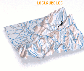 Places with similar names to Los Laureles, Venezuela ::
// Los Laureles (CU)
// Los Laureles (CL)
// Los Laureles (CL)
// Los Laureles (CL)
// Los Laureles (CO)
// Los Laureles (CO)
// Los Laureles (CO)
// Los Laureles (CO)
// Los Laureles (CO)
// Los Laureles (CO)
Disclaimer :: Information on this page comes without warranty of any kind |
||
|
Where is Los Laureles? Elevation and coordinates ::
Latitude (lat): 8°5'22"N Longitude (lon): 71°47'10"W
Elevation (approx.): 1787m (map arrows pan, magnifying glasses zoom) |
||
|
Visiting Los Laureles? Hotel/Accommodation ::
Book a hotel in Los Laureles Travel Guide ::
Buy a travel guide for Venezuela rental cars ::
car rental offers GPS waypoint ::
download a GPX waypoint (PoI) of Los Laureles for your GPS receiver
|
||