|
search place name
|
||
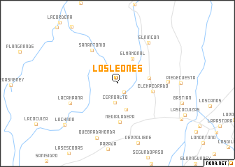
Los Leones (Lara, Venezuela)Los Leones is a town in the Lara region of Venezuela. An overview map of the region around Los Leones is displayed below.
regional and 3d topo map of Los Leones, Venezuela ::
Los Leones airports ::
The nearest airport is VLV - Valera Dr Antonio Nicolas Briceno, located 66.5 km south west of Los Leones.
Other airports nearby include BRM - Barquisimeto Intl (107.9 km east), GUQ - Guanare (114.1 km south east), AGV - Acarigua Oswaldo Guevara Mujica (125.4 km east), BNS - Barinas (140.6 km south), Nearby towns ::
Matias (1.7km south east) //
Cerro Alto (3.1km south) //
Palma Sola (4.4km south) //
El Mamonal (4.6km north east) //
Hato Bobo (5.1km east) //
El Empedrado (5.7km east) //
Media Ladera (6.3km south) //
San Antonio (6.6km north west) //
El Cerro (8.0km east) //
El Rincón (8.1km north east) //
La Campana (8.1km south west) //
Quebrada Honda (9.4km south) //
La Chara (10.6km south west) //
[all distances 'as the bird flies' and approximate] 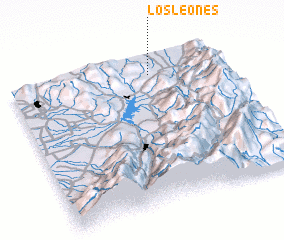 Places with similar names to Los Leones, Venezuela ::
// Los Leones (PA)
// Los Leones (PA)
// Los Llanos (PA)
// Los Llanos (PA)
// Los Llanos (PA)
// Las Llanas (ES)
// Las Salinas (ES)
// Las Salinas (ES)
// Las Salinas (ES)
// Las Salinas (ES)
Disclaimer :: Information on this page comes without warranty of any kind |
||
|
Where is Los Leones? Elevation and coordinates ::
Latitude (lat): 9°53'10"N Longitude (lon): 70°19'48"W
Elevation (approx.): 905m (map arrows pan, magnifying glasses zoom) |
||
|
Visiting Los Leones? Hotel/Accommodation ::
Book a hotel in Los Leones Travel Guide ::
Buy a travel guide for Venezuela rental cars ::
car rental offers GPS waypoint ::
download a GPX waypoint (PoI) of Los Leones for your GPS receiver
|
||