|
search place name
|
||
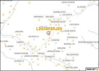
Los Naranjos (Barinas, Venezuela)Los Naranjos is a town in the Barinas region of Venezuela. An overview map of the region around Los Naranjos is displayed below.
regional and 3d topo map of Los Naranjos, Venezuela ::
Los Naranjos airports ::
The nearest airport is BNS - Barinas, located 39.3 km south east of Los Naranjos.
Other airports nearby include VLV - Valera Dr Antonio Nicolas Briceno (52.6 km north), GUQ - Guanare (79.7 km east), MRD - Merida Alberto Carnevalli (83.4 km south west), AGV - Acarigua Oswaldo Guevara Mujica (154.0 km north east), Nearby towns ::
El Guafal (0.9km south) //
Los Naranjitos (1.7km north) //
La Bellaca (1.8km south) //
La Sabana (2.3km north) //
La Honda (2.7km north east) //
San Ramon (2.7km south west) //
San Luis (3.0km north west) //
Guaito (3.2km east) //
Alto de Las Cruces (3.3km south) //
El Filo (3.3km south) //
Agua Fría (3.5km south west) //
La Honda (3.7km south east) //
Las Flores (4.2km north) //
La Laguna (4.5km south) //
Calderas (4.7km north east) //
Piedra de Moler (5.3km north east) //
La Cuchilla (5.5km north east) //
Los Bucares (5.7km south) //
San José (5.9km north) //
La Aguada (5.9km north) //
Potrerito (5.9km west) //
El Cedro (6.4km north) //
El Cañito (6.5km south west) //
El Potrerito (6.8km south west) //
La Ardita (6.8km east) //
Las Lajitas (6.8km north east) //
Palmarito (6.9km north east) //
Cruz Verde (7.0km north east) //
San Ramón (7.1km north west) //
[all distances 'as the bird flies' and approximate] 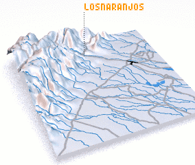 Places with similar names to Los Naranjos, Venezuela ::
// Los Naranjos (PA)
// Los Naranjos (PA)
// Los Naranjos (PA)
// Los Naranjos (PA)
// Los Naranjos (PA)
// Los Naranjos (PA)
// Los Naranjos (CU)
// Los Naranjos (CO)
// Los Naranjos (CO)
// Los Naranjos (CO)
Disclaimer :: Information on this page comes without warranty of any kind |
||
|
Where is Los Naranjos? Elevation and coordinates ::
Latitude (lat): 8°52'48"N Longitude (lon): 70°27'52"W
Elevation (approx.): 1060m (map arrows pan, magnifying glasses zoom) |
||
|
Visiting Los Naranjos? Hotel/Accommodation ::
Book a hotel in Los Naranjos Travel Guide ::
Buy a travel guide for Venezuela rental cars ::
car rental offers GPS waypoint ::
download a GPX waypoint (PoI) of Los Naranjos for your GPS receiver
|
||