|
search place name
|
||
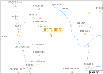
Los Tubos (Yaracuy, Venezuela)Los Tubos is a town in the Yaracuy region of Venezuela. An overview map of the region around Los Tubos is displayed below.
regional and 3d topo map of Los Tubos, Venezuela ::
Los Tubos airports ::
The nearest airport is BRM - Barquisimeto Intl, located 34.0 km north west of Los Tubos.
Other airports nearby include AGV - Acarigua Oswaldo Guevara Mujica (40.0 km south west), SFH - San Felipe Sub Teniente Nestor Arias (57.1 km north east), GUQ - Guanare (119.6 km south west), PBL - Puerto Cabello General Bartolome Salom Intl (129.7 km north east), Nearby towns ::
El Palmar (4.1km north west) //
La Perdomera (6.0km north west) //
Pilancones (6.2km south west) //
Gamelotal (7.8km south west) //
Barrio Nuevo (8.1km north west) //
Los Morochos (8.1km north east) //
Los Morochos (8.2km north east) //
El Roble (9.4km south west) //
El Rincón (9.4km north west) //
[all distances 'as the bird flies' and approximate] 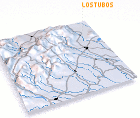 Places with similar names to Los Tubos, Venezuela ::
// Las Tibias (PA)
// Los Tibes (CU)
// Los Adobes (MX)
// Los Adobes (MX)
// Los Adobes (MX)
// Los Adobes (MX)
// Los Adobes (MX)
// Los Adobes (MX)
// Los Adobes (MX)
// Los Adobes (MX)
Disclaimer :: Information on this page comes without warranty of any kind |
||
|
Where is Los Tubos? Elevation and coordinates ::
Latitude (lat): 9°53'7"N Longitude (lon): 69°5'33"W
Elevation (approx.): 380m (map arrows pan, magnifying glasses zoom) |
||
|
Visiting Los Tubos? Hotel/Accommodation ::
Book a hotel in Los Tubos Travel Guide ::
Buy a travel guide for Venezuela rental cars ::
car rental offers GPS waypoint ::
download a GPX waypoint (PoI) of Los Tubos for your GPS receiver
|
||