|
search place name
|
||
Maitanita (Miranda, Venezuela)Maitanita is a town in the Miranda region of Venezuela. An overview map of the region around Maitanita is displayed below.
regional and 3d topo map of Maitanita, Venezuela ::

Maitanita airports ::
The nearest airport is CCS - Caracas Simon Bolivar Intl, located 34.8 km north of Maitanita.
Other airports nearby include VLN - Valencia Arturo Michelena Intl (113.4 km west), PBL - Puerto Cabello General Bartolome Salom Intl (129.4 km west), VDP - Valle De La Pascua (155.7 km south east), SFH - San Felipe Sub Teniente Nestor Arias (202.7 km west), Nearby towns ::
Cortada de Maturín (1.5km north east) //
El Carmen (1.9km north) //
Maturín (2.7km east) //
El Respiro (3.0km north east) //
La Hoyadita (3.0km north east) //
El Salto del Diablo (3.0km north east) //
Maitana (3.0km north east) //
La Lola (3.0km north east) //
Popuere (3.0km west) //
Boca de Mesía (3.4km south east) //
Helechal (3.5km east) //
El Peñón (3.5km north west) //
Agua Fria (3.7km north east) //
El Peñón (3.7km north) //
La Vuelta del Muerto (3.7km north) //
Cachicamo (3.6km south west) //
Los Lirios (3.7km south west) //
Buena Vista (3.7km east) //
El Aguacatal (4.0km north) //
Cocorote (4.0km west) //
Los Anaucos (4.1km east) //
Chupulún (4.1km west) //
San Antonio (4.2km west) //
San Joaquín (4.3km north east) //
Mapurite (4.3km west) //
Arcos (4.5km south east) //
El Vapor (4.6km north east) //
Guayabital (4.6km north) //
Gamelotal (4.6km south east) //
[all distances 'as the bird flies' and approximate] 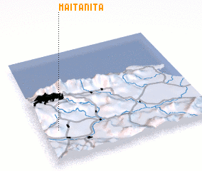 Places with similar names to Maitanita, Venezuela ::
Disclaimer :: Information on this page comes without warranty of any kind |
||
|
Where is Maitanita? Elevation and coordinates ::
Latitude (lat): 10°18'2"N Longitude (lon): 66°54'18"W
Elevation (approx.): 795m (map arrows pan, magnifying glasses zoom) |
||
|
Visiting Maitanita? Hotel/Accommodation ::
Book a hotel in Maitanita Travel Guide ::
Buy a travel guide for Venezuela rental cars ::
car rental offers GPS waypoint ::
download a GPX waypoint (PoI) of Maitanita for your GPS receiver
|
||