|
search place name
|
||
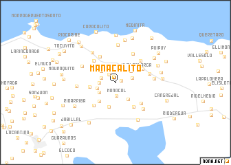
Manacalito (Sucre, Venezuela)Manacalito is a town in the Sucre region of Venezuela. An overview map of the region around Manacalito is displayed below.
regional and 3d topo map of Manacalito, Venezuela ::
Manacalito airports ::
The nearest airport is CUP - Carupano General Jose Francisco Bermudez, located 24.3 km west of Manacalito.
Other airports nearby include GUI - Guiria (80.0 km east), MUN - Maturin (99.2 km south), PMV - Porlamar Del Caribe Intl Gen Santiago Marino (105.8 km west), CUM - Cumana Antonio Jose De Sucre (121.1 km west), Nearby towns ::
Catuaro (0.9km north) //
Lucía (1.0km east) //
Río Chiquito Abajo (1.6km north west) //
Manacal (2.2km south) //
Chacaracual (2.3km north east) //
Quebrada Seca (2.3km north west) //
Río Chiquito (2.3km west) //
Catuarito (2.6km west) //
Río Santiago (2.8km east) //
Cangrejo (2.9km north west) //
Santa Rosa (3.0km west) //
Buena Vista (3.0km south west) //
Caraquita (3.1km north east) //
Campo Alegre (3.4km south east) //
Vuelta Larga (3.9km north east) //
La Cumbre Mariano León (4.0km south west) //
Cumbre de Manacal (4.1km south) //
Santa María (4.1km west) //
Río Salado (4.8km north west) //
Palenque (4.9km north west) //
Agua Dulce (4.9km north east) //
Platanito Arriba (5.0km south east) //
Catuaro Arriba (5.1km south west) //
Quebrada de Mono (5.3km south east) //
El Pailón (5.3km north east) //
Quebrada Honda (5.4km north east) //
Guarapiche (5.6km east) //
Patucutal (5.9km north west) //
Agua Dulce (6.1km north) //
[all distances 'as the bird flies' and approximate] 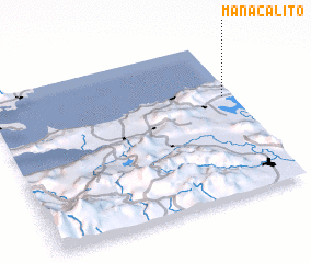 Places with similar names to Manacalito, Venezuela ::
// Mangaladaw (MM)
// Manacolod (PH)
// Mañgalit (PH)
// Manglad (PH)
// Manglit (PH)
// Mangualde (PT)
// Mangualde (PT)
// Manguelito (CO)
// Manguelito (CO)
// Mangaldai (IN)
Disclaimer :: Information on this page comes without warranty of any kind |
||
|
Where is Manacalito? Elevation and coordinates ::
Latitude (lat): 10°38'20"N Longitude (lon): 63°2'26"W
Elevation (approx.): 175m (map arrows pan, magnifying glasses zoom) |
||
|
Visiting Manacalito? Hotel/Accommodation ::
Book a hotel in Manacalito Travel Guide ::
Buy a travel guide for Venezuela rental cars ::
car rental offers GPS waypoint ::
download a GPX waypoint (PoI) of Manacalito for your GPS receiver
|
||