|
search place name
|
||
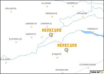
Merecure (Apure, Venezuela)Merecure is a town in the Apure region of Venezuela. An overview map of the region around Merecure is displayed below.
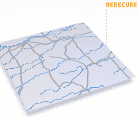
regional and 3d topo map of Merecure, Venezuela ::
Merecure airports ::
The nearest airport is SFD - San Fernando De Apure, located 70.6 km north east of Merecure.
Other airports nearby include PCR - Puerto Carreno (162.8 km south), PYH - Puerto Ayacucho Casique Aramare (219.6 km south), GUQ - Guanare (251.9 km north west), AGV - Acarigua Oswaldo Guevara Mujica (258.5 km north west), Nearby towns ::
 Places with similar names to Merecure, Venezuela ::
Disclaimer :: Information on this page comes without warranty of any kind |
||
|
Where is Merecure? Elevation and coordinates ::
Latitude (lat): 7°34'0"N Longitude (lon): 68°0'0"W
Elevation (approx.): 57m (map arrows pan, magnifying glasses zoom) |
||
|
Visiting Merecure? Hotel/Accommodation ::
Book a hotel in Merecure Travel Guide ::
Buy a travel guide for Venezuela rental cars ::
car rental offers GPS waypoint ::
download a GPX waypoint (PoI) of Merecure for your GPS receiver
|
||