|
search place name
|
||
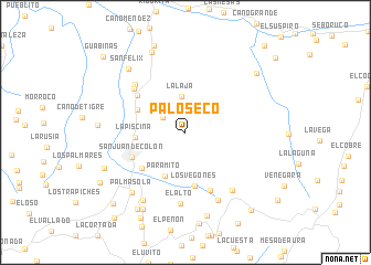
Palo Seco (Táchira, Venezuela)Palo Seco is a town in the Táchira region of Venezuela. An overview map of the region around Palo Seco is displayed below.
regional and 3d topo map of Palo Seco, Venezuela ::
Palo Seco airports ::
The nearest airport is LFR - La Fria, located 21.1 km north of Palo Seco.
Other airports nearby include SVZ - San Antonio Del Tachira (35.6 km south west), CUC - Cucuta Camilo Daza (37.0 km south west), STD - Santo Domingo Mayor Buenaventura Vivas (57.8 km south), STB - Santa Barbara Del Zulia (105.1 km north), Nearby towns ::
Las Blancas (2.7km north west) //
La Laja (3.6km north) //
Paramito (4.9km south west) //
La Piscina (5.1km west) //
Las Cruces (5.4km north west) //
Los Vegones (5.5km south) //
Las Flores (5.7km south west) //
San Juan de Colón (5.9km south west) //
El Caliche (6.1km north west) //
La Enfadosa (6.3km south east) //
Rivas (6.8km north west) //
Paraguito (7.0km north west) //
El Alto (7.2km south) //
Boca de Monte (7.5km south east) //
La Travesía (7.6km south east) //
La Jabonosa (8.1km south west) //
Palma Sola (8.1km south west) //
San Félix (8.6km north west) //
Las Lapas (8.7km south) //
La Uracá (8.8km north) //
La Carbonera (8.9km south west) //
La Rinconada (8.8km west) //
Las Quebraditas (8.9km south west) //
Angostura (9.2km south west) //
San Isidro (9.3km north) //
Agua Linda (9.3km north east) //
La Honda (9.7km south west) //
Morrachón (9.9km south west) //
San Pedro del Río (10.2km south west) //
[all distances 'as the bird flies' and approximate]  Places with similar names to Palo Seco, Venezuela ::
Disclaimer :: Information on this page comes without warranty of any kind |
||
|
Where is Palo Seco? Elevation and coordinates ::
Latitude (lat): 8°3'37"N Longitude (lon): 72°12'13"W
Elevation (approx.): 1224m (map arrows pan, magnifying glasses zoom) |
||
|
Visiting Palo Seco? Hotel/Accommodation ::
Book a hotel in Palo Seco Travel Guide ::
Buy a travel guide for Venezuela rental cars ::
car rental offers GPS waypoint ::
download a GPX waypoint (PoI) of Palo Seco for your GPS receiver
|
||