|
search place name
|
||
Pardillal (Aragua, Venezuela)Pardillal is a town in the Aragua region of Venezuela. An overview map of the region around Pardillal is displayed below.
regional and 3d topo map of Pardillal, Venezuela ::

Pardillal airports ::
The nearest airport is CCS - Caracas Simon Bolivar Intl, located 72.4 km north of Pardillal.
Other airports nearby include VLN - Valencia Arturo Michelena Intl (100.6 km west), PBL - Puerto Cabello General Bartolome Salom Intl (128.1 km north west), VDP - Valle De La Pascua (139.7 km south east), SFH - San Felipe Sub Teniente Nestor Arias (192.2 km west), Nearby towns ::
San Rafael (3.7km north) //
El Rosario (5.2km south west) //
Los Dos Caminos (5.6km south) //
San Casimiro (5.9km north) //
Morro la Cruz (6.6km south east) //
Cogollal (6.6km south east) //
Zuata (6.7km south west) //
Las Dos Quebradas (6.9km north) //
El Cogedero (6.9km south east) //
Guasdual (7.2km north) //
El Guasdual (7.8km east) //
Boca del Negro (8.7km north east) //
Roncador (8.9km north) //
Carutico (8.9km north) //
El Negro (9.2km north east) //
Vargas (9.5km north west) //
Bejucal (9.6km north east) //
La Chivera (9.8km north east) //
Las Rosas (10.4km north east) //
San José (10.4km south west) //
El Paraparo (10.5km north west) //
El Peaje (10.7km north west) //
[all distances 'as the bird flies' and approximate] 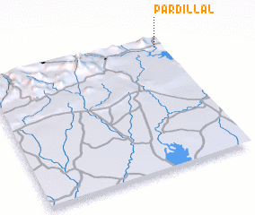 Places with similar names to Pardillal, Venezuela ::
// Pardillal (CO)
// Par de là lʼEau (BE)
Disclaimer :: Information on this page comes without warranty of any kind |
||
|
Where is Pardillal? Elevation and coordinates ::
Latitude (lat): 9°57'0"N Longitude (lon): 67°2'0"W
Elevation (approx.): 507m (map arrows pan, magnifying glasses zoom) |
||
|
Visiting Pardillal? Hotel/Accommodation ::
Book a hotel in Pardillal Travel Guide ::
Buy a travel guide for Venezuela rental cars ::
car rental offers GPS waypoint ::
download a GPX waypoint (PoI) of Pardillal for your GPS receiver
|
||