|
search place name
|
||
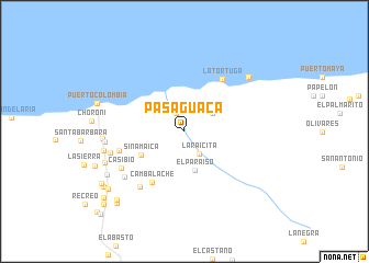
Pasaguaca (Aragua, Venezuela)Pasaguaca is a town in the Aragua region of Venezuela. An overview map of the region around Pasaguaca is displayed below.
regional and 3d topo map of Pasaguaca, Venezuela ::
Pasaguaca airports ::
The nearest airport is VLN - Valencia Arturo Michelena Intl, located 57.5 km south west of Pasaguaca.
Other airports nearby include PBL - Puerto Cabello General Bartolome Salom Intl (59.9 km west), CCS - Caracas Simon Bolivar Intl (60.1 km east), SFH - San Felipe Sub Teniente Nestor Arias (136.5 km west), BON - Kralendijk Flamingo (199.4 km north west), Nearby towns ::
Chuao (1.1km north) //
Tamairito (2.0km north west) //
La Raicita (2.7km south east) //
Ceped (3.3km north east) //
El Paraíso (4.1km south) //
Sinamaica (4.9km south west) //
Cambalache (6.1km south west) //
La Tortuga (6.5km north east) //
La Cesiva (6.8km west) //
Los Rastrojos (7.2km south west) //
Casibio (7.3km south west) //
San Pablo (7.5km south west) //
Payares (7.7km west) //
El Mamón (8.1km west) //
Santa Apolonia (8.2km west) //
Santa Polonia (8.3km west) //
Cuyay (8.5km north east) //
El Placer (8.6km west) //
Parapara (8.9km south west) //
Puerto Colombia (9.2km west) //
Uraca (9.6km south west) //
Los Bañaderos (9.7km south west) //
La Candelaria (9.8km south west) //
El Guarenal (9.9km south west) //
Hondurita (10.0km south west) //
La Esmeralda (10.6km south west) //
Esmeralda (11.0km south west) //
Tremaria (11.9km south west) //
Fajardo (12.0km south west) //
[all distances 'as the bird flies' and approximate] 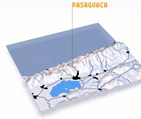 Places with similar names to Pasaguaca, Venezuela ::
Disclaimer :: Information on this page comes without warranty of any kind |
||
|
Where is Pasaguaca? Elevation and coordinates ::
Latitude (lat): 10°29'2"N Longitude (lon): 67°31'33"W
Elevation (approx.): 50m (map arrows pan, magnifying glasses zoom) |
||
|
Visiting Pasaguaca? Hotel/Accommodation ::
Book a hotel in Pasaguaca Travel Guide ::
Buy a travel guide for Venezuela rental cars ::
car rental offers GPS waypoint ::
download a GPX waypoint (PoI) of Pasaguaca for your GPS receiver
|
||