|
search place name
|
||
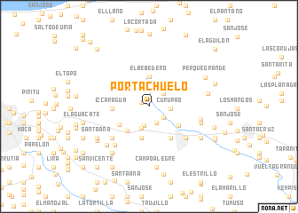
Portachuelo (Miranda, Venezuela)Portachuelo is a town in the Miranda region of Venezuela. An overview map of the region around Portachuelo is displayed below.
regional and 3d topo map of Portachuelo, Venezuela ::
Portachuelo airports ::
The nearest airport is CCS - Caracas Simon Bolivar Intl, located 38.0 km west of Portachuelo.
Other airports nearby include VLN - Valencia Arturo Michelena Intl (144.5 km west), PBL - Puerto Cabello General Bartolome Salom Intl (154.9 km west), VDP - Valle De La Pascua (159.3 km south east), BLA - Barcelona General Jose Antonio Anzoategui Intl (220.1 km east), Nearby towns ::
Cogollal (1.0km north west) //
El Cercado (2.3km south east) //
La Montañita (2.3km south east) //
La Estrella (2.4km south) //
Plan de La Viuda (2.4km north east) //
Curupao (2.7km east) //
Manguito (2.9km south) //
El Bebedero (3.8km north) //
Mampote (4.1km south) //
Cujicito (4.1km south west) //
Plan Germán Díaz (4.3km north east) //
Bella Vista (4.3km south west) //
La Guairita (4.4km south east) //
Izcaragua (4.6km west) //
El Tamarindo (4.8km south east) //
Trapichito (6.0km south east) //
La Comunidad (6.0km south east) //
Maturín (6.0km south east) //
Guarenas (6.0km south east) //
Los Largos (6.0km south west) //
Campo Alegre (6.0km south west) //
Brazo Seco (6.0km south west) //
Ochoa (6.0km south west) //
Agua Dulce (6.5km south west) //
Los Naranjos (6.6km east) //
La Fundación (6.7km east) //
La Mina (7.1km south west) //
El Castaño (7.4km south west) //
Perque (7.5km east) //
[all distances 'as the bird flies' and approximate]  Places with similar names to Portachuelo, Venezuela ::
// Portachuelo (PA)
// Pratts Hollow (US)
// Portachuelo (CO)
// Portachuelo (CO)
// Portachuelo (CO)
// Portachuelo (CO)
// Portachuelo (CO)
// Portachuelo (CO)
// Portachuelo (PE)
// Portachuelo (PE)
Disclaimer :: Information on this page comes without warranty of any kind |
||
|
Where is Portachuelo? Elevation and coordinates ::
Latitude (lat): 10°30'8"N Longitude (lon): 66°39'30"W
Elevation (approx.): 604m (map arrows pan, magnifying glasses zoom) |
||
|
Visiting Portachuelo? Hotel/Accommodation ::
Book a hotel in Portachuelo Travel Guide ::
Buy a travel guide for Venezuela rental cars ::
car rental offers GPS waypoint ::
download a GPX waypoint (PoI) of Portachuelo for your GPS receiver
|
||