|
search place name
|
||
Puerto Escondido (Falcón, Venezuela)Puerto Escondido is a town in the Falcón region of Venezuela. An overview map of the region around Puerto Escondido is displayed below.
regional and 3d topo map of Puerto Escondido, Venezuela ::

Puerto Escondido airports ::
The nearest airport is AUA - Oranjestad Reina Beatrix Intl, located 35.9 km north of Puerto Escondido.
Other airports nearby include LSP - Paraguana Josefa Camejo (49.6 km south west), CZE - Coro Jose Leonardo Chirinos (89.9 km south), CUR - Willemstad Hato (107.8 km east), BON - Kralendijk Flamingo (183.1 km east), Nearby towns ::
Galera (4.1km south west) //
Santa Rita (4.1km south east) //
San Francisco (5.2km south west) //
El Imujo (7.5km south west) //
San Francisco (7.5km west) //
San Lorenzo (8.1km south west) //
Bajo Aroa (8.2km west) //
El Zaíno (8.4km south west) //
Las Cumaraguas (9.2km south east) //
La Urupagua (10.0km south west) //
Palmira (11.2km south west) //
[all distances 'as the bird flies' and approximate] 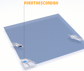 Places with similar names to Puerto Escondido, Venezuela ::
// Puerto Escondido (PA)
// Puerto Escondido (PA)
// Puerto Escondido (PA)
// Puerto Escondido (PA)
// Puerto Escondido (CU)
// Puerto Escondido (CU)
// Puerto Escondido (CU)
// Puerto Escondido (CU)
// Puerto Escondido (CO)
// Puerto Escondido (CR)
Disclaimer :: Information on this page comes without warranty of any kind |
||
|
Where is Puerto Escondido? Elevation and coordinates ::
Latitude (lat): 12°11'0"N Longitude (lon): 69°57'0"W
Elevation (approx.): -32768m (map arrows pan, magnifying glasses zoom) |
||
|
Visiting Puerto Escondido? Hotel/Accommodation ::
Book a hotel in Puerto Escondido Travel Guide ::
Buy a travel guide for Venezuela rental cars ::
car rental offers GPS waypoint ::
download a GPX waypoint (PoI) of Puerto Escondido for your GPS receiver
|
||