|
search place name
|
||
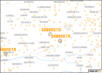
Sabaneta (Miranda, Venezuela)Sabaneta is a town in the Miranda region of Venezuela. An overview map of the region around Sabaneta is displayed below.
regional and 3d topo map of Sabaneta, Venezuela ::
Sabaneta airports ::
The nearest airport is CCS - Caracas Simon Bolivar Intl, located 34.1 km north of Sabaneta.
Other airports nearby include VLN - Valencia Arturo Michelena Intl (93.0 km west), PBL - Puerto Cabello General Bartolome Salom Intl (108.6 km west), VDP - Valle De La Pascua (170.8 km south east), SFH - San Felipe Sub Teniente Nestor Arias (181.8 km west), Nearby towns ::
Las Mostazas (1.4km east) //
El Tigrito (1.4km east) //
El Encanto (2.0km south east) //
Caimito (2.6km north east) //
Agua Amarilla (3.2km north west) //
Quebrada de Guayas (3.3km south) //
Quebrada de Guayas (3.3km south) //
Caña Larga (3.5km south east) //
El Trabuco (3.7km east) //
Guaracarumbo (3.7km south) //
La Gasera (3.8km north west) //
Pozo de Rosa (3.9km north west) //
La Ermita (3.9km west) //
La Begonia (4.0km south west) //
Puerta Morocha (4.2km south east) //
Limoncito (4.1km south east) //
Sabaneta (4.2km south east) //
Las Dalias (4.3km north east) //
La Hondonada (4.4km north east) //
El Barniz (4.7km north west) //
Maturín (4.7km north west) //
Las Lajas (4.8km north west) //
El Reten (4.8km north east) //
Variante (5.0km south) //
Los Canales (5.2km east) //
Boquerón (5.3km south) //
La Florida (5.5km north) //
Jabillar (5.5km south) //
Las Flores (5.6km south west) //
[all distances 'as the bird flies' and approximate] 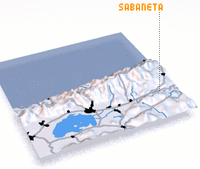 Places with similar names to Sabaneta, Venezuela ::
Disclaimer :: Information on this page comes without warranty of any kind |
||
|
Where is Sabaneta? Elevation and coordinates ::
Latitude (lat): 10°18'46"N Longitude (lon): 67°5'44"W
Elevation (approx.): 1360m (map arrows pan, magnifying glasses zoom) |
||
|
Visiting Sabaneta? Hotel/Accommodation ::
Book a hotel in Sabaneta Travel Guide ::
Buy a travel guide for Venezuela rental cars ::
car rental offers GPS waypoint ::
download a GPX waypoint (PoI) of Sabaneta for your GPS receiver
|
||