|
search place name
|
||
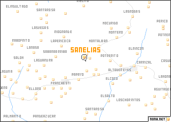
San Elías (Carabobo, Venezuela)San Elías is a town in the Carabobo region of Venezuela. An overview map of the region around San Elías is displayed below.
regional and 3d topo map of San Elías, Venezuela ::
San Elías airports ::
The nearest airport is PBL - Puerto Cabello General Bartolome Salom Intl, located 44.7 km north east of San Elías.
Other airports nearby include SFH - San Felipe Sub Teniente Nestor Arias (45.3 km west), VLN - Valencia Arturo Michelena Intl (46.7 km east), BRM - Barquisimeto Intl (111.4 km west), AGV - Acarigua Oswaldo Guevara Mujica (119.7 km south west), Nearby towns ::
Agua de Obispo (1.2km north east) //
Las Cañadas (1.5km north) //
Juan Ignacio (2.2km south) //
Las Matas (2.9km south east) //
Paso Real (3.5km south east) //
Sabaneta (4.1km south east) //
Papayo (4.4km south) //
Montalbán (4.4km north east) //
Potrerito (5.3km east) //
Miranda (5.7km south west) //
La Pericoca (6.2km north west) //
Sabana Arriba (6.5km west) //
El Juncal (6.8km south west) //
Río Grande (7.0km north west) //
El Coco (7.7km south east) //
Sabana de Aguirre (7.7km east) //
Franchesti (7.9km south west) //
El Tigre (8.1km south west) //
Alto de Reyes (8.2km east) //
Santo Tomás (8.3km south west) //
Montero (8.5km north east) //
Mocurido (9.1km north east) //
El Tañero (9.2km south west) //
El Hoyo (9.3km south west) //
Santo Domingo (9.3km south west) //
La Araguata (9.3km west) //
El Salto (10.1km south east) //
Temerla (11.9km north west) //
[all distances 'as the bird flies' and approximate] 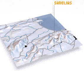 Places with similar names to San Elías, Venezuela ::
Disclaimer :: Information on this page comes without warranty of any kind |
||
|
Where is San Elías? Elevation and coordinates ::
Latitude (lat): 10°11'12"N Longitude (lon): 68°21'10"W
Elevation (approx.): 677m (map arrows pan, magnifying glasses zoom) |
||
|
Visiting San Elías? Hotel/Accommodation ::
Book a hotel in San Elías Travel Guide ::
Buy a travel guide for Venezuela rental cars ::
car rental offers GPS waypoint ::
download a GPX waypoint (PoI) of San Elías for your GPS receiver
|
||