|
search place name
|
||
Sanguijuela (Sucre, Venezuela)Sanguijuela is a town in the Sucre region of Venezuela. An overview map of the region around Sanguijuela is displayed below.
regional and 3d topo map of Sanguijuela, Venezuela ::

Sanguijuela airports ::
The nearest airport is CUP - Carupano General Jose Francisco Bermudez, located 6.7 km north west of Sanguijuela.
Other airports nearby include PMV - Porlamar Del Caribe Intl Gen Santiago Marino (87.8 km north west), MUN - Maturin (95.7 km south), GUI - Guiria (99.9 km east), CUM - Cumana Antonio Jose De Sucre (100.7 km west), Nearby towns ::
Carate (1.6km north west) //
Charallave (1.9km west) //
Caratalito (2.0km north east) //
La Cumbre (2.1km south east) //
Tunapuicito (3.0km south east) //
Canchunchu Viejo (3.2km north west) //
Vuelta de la Burra (3.3km north west) //
Cusma (3.5km north) //
El Calvario (3.4km east) //
El Charcal (3.5km south west) //
El Rincón (3.5km south east) //
La Hoyada (3.6km north east) //
Caratal (3.8km south) //
Chipichipe (3.8km north) //
Maturincito (3.9km east) //
Gran Pobre (4.1km south west) //
Canaima (4.3km north east) //
San Basilio (4.4km south east) //
Carúpano Arriba (4.6km north) //
Chuparipal (4.8km south east) //
La Laguna (4.9km south east) //
El Rincón (5.0km south) //
El Muco (5.1km west) //
La Soledad (5.2km south) //
Guasimal (5.3km south east) //
Guayacán de las Flores (5.4km north west) //
Sabaneta (5.5km east) //
Loma de Chuparipal (5.9km south west) //
Punta Brava (6.0km east) //
[all distances 'as the bird flies' and approximate] 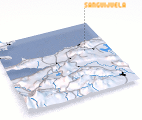 Places with similar names to Sanguijuela, Venezuela ::
// Sankijala (BD)
// Singjāla (BD)
// Sanguijuela (CO)
// Sanguijuela (MX)
// Sanguijuela (MX)
// Sanguijuela (MX)
// Sanguijuela (MX)
// Sanguijuela (MX)
// Sanguijuela (MX)
// Sanguijuela (HN)
Disclaimer :: Information on this page comes without warranty of any kind |
||
|
Where is Sanguijuela? Elevation and coordinates ::
Latitude (lat): 10°36'40"N Longitude (lon): 63°13'30"W
Elevation (approx.): 492m (map arrows pan, magnifying glasses zoom) |
||
|
Visiting Sanguijuela? Hotel/Accommodation ::
Book a hotel in Sanguijuela Travel Guide ::
Buy a travel guide for Venezuela rental cars ::
car rental offers GPS waypoint ::
download a GPX waypoint (PoI) of Sanguijuela for your GPS receiver
|
||