|
search place name
|
||
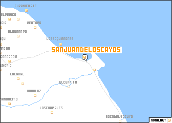
San Juan de los Cayos (Falcón, Venezuela)San Juan de los Cayos is a town in the Falcón region of Venezuela. An overview map of the region around San Juan de los Cayos is displayed below.
regional and 3d topo map of San Juan de los Cayos, Venezuela ::
San Juan de los Cayos airports ::
The nearest airport is PBL - Puerto Cabello General Bartolome Salom Intl, located 84.7 km south east of San Juan de los Cayos.
Other airports nearby include SFH - San Felipe Sub Teniente Nestor Arias (105.0 km south), BON - Kralendijk Flamingo (107.9 km north), VLN - Valencia Arturo Michelena Intl (124.5 km south east), CUR - Willemstad Hato (127.6 km north west), Nearby towns ::
Boca de Mangle (2.6km south east) //
Los Taparos (4.1km north west) //
El Cerrito (6.6km south west) //
Los Boquerones (6.6km north west) //
[all distances 'as the bird flies' and approximate] 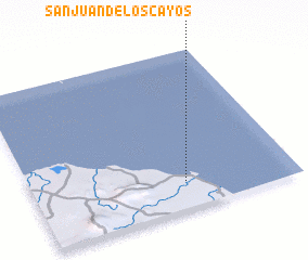 Places with similar names to San Juan de los Cayos, Venezuela :: Disclaimer :: Information on this page comes without warranty of any kind |
||
|
Where is San Juan de los Cayos? Elevation and coordinates ::
Latitude (lat): 11°10'0"N Longitude (lon): 68°25'0"W
Elevation (approx.): 3m (map arrows pan, magnifying glasses zoom) |
||
|
Visiting San Juan de los Cayos? Hotel/Accommodation ::
Book a hotel in San Juan de los Cayos Travel Guide ::
Buy a travel guide for Venezuela rental cars ::
car rental offers GPS waypoint ::
download a GPX waypoint (PoI) of San Juan de los Cayos for your GPS receiver
|
||