|
search place name
|
||
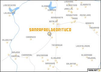
San Rafael de Orituco (Guárico, Venezuela)San Rafael de Orituco is a town in the Guárico region of Venezuela. An overview map of the region around San Rafael de Orituco is displayed below.
regional and 3d topo map of San Rafael de Orituco, Venezuela ::
San Rafael de Orituco airports ::
The nearest airport is VDP - Valle De La Pascua, located 80.2 km south east of San Rafael de Orituco.
Other airports nearby include CCS - Caracas Simon Bolivar Intl (107.6 km north west), VLN - Valencia Arturo Michelena Intl (170.9 km west), BLA - Barcelona General Jose Antonio Anzoategui Intl (190.8 km east), PBL - Puerto Cabello General Bartolome Salom Intl (196.8 km west), Nearby towns ::
La Cruz (0.8km south east) //
Botalón (4.7km north) //
Tocoragua (4.9km south east) //
Altagracia de Orituco (5.2km north east) //
Peña de Mota (6.4km north) //
Camoruco (7.3km west) //
Oruz Arriba (8.6km south) //
Guanape (8.7km north) //
Las Iguanitas (9.0km south) //
Los Dos Caminos (9.3km north east) //
Ipare (10.2km north east) //
Mosquitero (10.4km north east) //
Carapa (11.7km north east) //
Chaparral (11.8km south west) //
[all distances 'as the bird flies' and approximate] 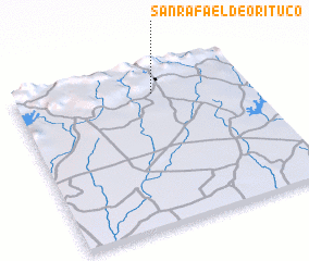 Places with similar names to San Rafael de Orituco, Venezuela :: Disclaimer :: Information on this page comes without warranty of any kind |
||
|
Where is San Rafael de Orituco? Elevation and coordinates ::
Latitude (lat): 9°49'18"N Longitude (lon): 66°24'18"W
Elevation (approx.): 322m (map arrows pan, magnifying glasses zoom) |
||
|
Visiting San Rafael de Orituco? Hotel/Accommodation ::
Book a hotel in San Rafael de Orituco Travel Guide ::
Buy a travel guide for Venezuela rental cars ::
car rental offers GPS waypoint ::
download a GPX waypoint (PoI) of San Rafael de Orituco for your GPS receiver
|
||