|
search place name
|
||
Santa Rita (Miranda, Venezuela)Santa Rita is a town in the Miranda region of Venezuela. An overview map of the region around Santa Rita is displayed below.
regional and 3d topo map of Santa Rita, Venezuela ::

Santa Rita airports ::
The nearest airport is CCS - Caracas Simon Bolivar Intl, located 52.8 km west of Santa Rita.
Other airports nearby include VDP - Valle De La Pascua (156.4 km south), VLN - Valencia Arturo Michelena Intl (161.0 km west), PBL - Puerto Cabello General Bartolome Salom Intl (171.0 km west), BLA - Barcelona General Jose Antonio Anzoategui Intl (205.3 km east), Nearby towns ::
Los Cedrales (0.6km south west) //
Las Corujas (2.1km north) //
Las Planadas (2.6km south) //
La Siria (3.5km south) //
La Esperanza (4.2km south west) //
Silma (4.3km south) //
Buena Vista (5.7km south east) //
Rincón Abajo (6.7km south) //
Rincón Arriba (6.7km south) //
Los Mangos (6.7km south west) //
San José (6.8km north west) //
El Machete (7.5km south east) //
Perquito (7.9km west) //
El Desvio (8.0km south) //
Majagual (8.0km east) //
San Pablo (8.2km south east) //
Río Arriba (8.3km south east) //
La Carbonera (8.4km south) //
Guatire (8.4km south) //
Santa Cruz (8.4km south) //
El Aguilón (8.3km west) //
Osma (8.6km north) //
Quemadito (8.6km south) //
San José (8.6km south west) //
Las Barrancas (8.8km south west) //
El Palmar (9.1km south west) //
El Ingenio (9.1km south west) //
Perque (9.0km west) //
El Pantano (9.2km north west) //
[all distances 'as the bird flies' and approximate] 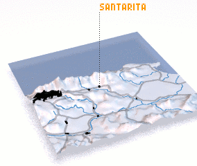 Places with similar names to Santa Rita, Venezuela ::
// Santa Rita (BR)
// Santa Rita (BR)
// Santa Rita (BR)
// Santa Rita (BR)
// Santa Rita (BR)
// Santa Rita (BR)
// Santa Rita (BR)
// Santa Rita (BR)
// Santa Rita (BR)
// Santa Rita (BR)
Disclaimer :: Information on this page comes without warranty of any kind |
||
|
Where is Santa Rita? Elevation and coordinates ::
Latitude (lat): 10°32'22"N Longitude (lon): 66°30'44"W
Elevation (approx.): 1343m (map arrows pan, magnifying glasses zoom) |
||
|
Visiting Santa Rita? Hotel/Accommodation ::
Book a hotel in Santa Rita Travel Guide ::
Buy a travel guide for Venezuela rental cars ::
car rental offers GPS waypoint ::
download a GPX waypoint (PoI) of Santa Rita for your GPS receiver
|
||