|
search place name
|
||
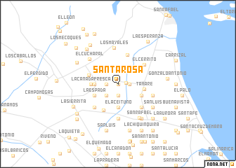
Santa Rosa (Zulia, Venezuela)Santa Rosa is a town in the Zulia region of Venezuela. An overview map of the region around Santa Rosa is displayed below.
regional and 3d topo map of Santa Rosa, Venezuela ::
Santa Rosa airports ::
The nearest airport is MAR - Maracaibo La Chinita Intl, located 35.0 km south of Santa Rosa.
Other airports nearby include RCH - Rio Hacha Almirante Padilla (143.0 km north west), VUP - Valledupar Alfonso Lopez Pumarejo (165.6 km west), LSP - Paraguana Josefa Camejo (206.4 km north east), STB - Santa Barbara Del Zulia (209.9 km south), Nearby towns ::
El Pozo (0.0km north) //
Cienega de Reyes (1.3km east) //
Las Prendas (1.9km south) //
San Juan (1.8km west) //
Bella Vista (1.8km east) //
La Fortuna (2.6km south west) //
El Picante (3.6km west) //
El Aceituno (3.7km south) //
El Hatico (4.1km south east) //
La Espada (4.1km south west) //
La Cañada Fresca (4.2km west) //
Tamare (4.2km east) //
Tamare Arriba (4.8km south west) //
Jaguey Nuevo (4.7km west) //
El Ciruelo Arriba (4.9km north) //
El Cerrito (5.2km north east) //
La Vaca (5.2km south east) //
La Icoleta (5.2km south west) //
La Loma (5.6km south) //
El Bolívar (5.6km south) //
Los Mayales (5.8km north) //
Esperanza (5.8km east) //
El Cucharal (6.0km north west) //
San Rafael (6.3km south east) //
La Aurora (6.6km south east) //
San Luis (6.6km south east) //
Santa Lucía (7.3km north west) //
El Pozo Blanco (7.4km north west) //
Los Bejucos (7.6km north west) //
[all distances 'as the bird flies' and approximate]  Places with similar names to Santa Rosa, Venezuela ::
// Sania Torres (MA)
// Santa Rosa (BR)
// Santa Rosa (BR)
// Santa Rosa (BR)
// Santa Rosa (BR)
// Santa Rosa (BR)
// Santa Rosa (BR)
// Santa Rosa (BR)
// Santa Rosa (BR)
// Santa Rosa (BR)
Disclaimer :: Information on this page comes without warranty of any kind |
||
|
Where is Santa Rosa? Elevation and coordinates ::
Latitude (lat): 10°52'0"N Longitude (lon): 71°48'0"W
Elevation (approx.): 33m (map arrows pan, magnifying glasses zoom) |
||
|
Visiting Santa Rosa? Hotel/Accommodation ::
Book a hotel in Santa Rosa Travel Guide ::
Buy a travel guide for Venezuela rental cars ::
car rental offers GPS waypoint ::
download a GPX waypoint (PoI) of Santa Rosa for your GPS receiver
|
||