|
search place name
|
||
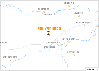
Sol y Sombra (Apure, Venezuela)Sol y Sombra is a town in the Apure region of Venezuela. An overview map of the region around Sol y Sombra is displayed below.
regional and 3d topo map of Sol y Sombra, Venezuela ::
Sol y Sombra airports ::
The nearest airport is PCR - Puerto Carreno, located 159.6 km south east of Sol y Sombra.
Other airports nearby include SFD - San Fernando De Apure (174.3 km north east), PYH - Puerto Ayacucho Casique Aramare (191.7 km south east), BNS - Barinas (248.2 km north west), Nearby towns ::
El Porvenir (4.1km south east) //
La Campanita (5.6km south) //
Cuartel Yaruro (5.7km south east) //
Mata de Canoa (5.8km east) //
Laurelcito (6.9km north) //
Las Campanas (7.8km east) //
San Andrés (9.1km north) //
[all distances 'as the bird flies' and approximate] 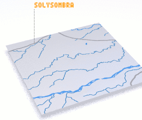 Places with similar names to Sol y Sombra, Venezuela ::
// Sol y Sombra (CO)
// Sol y Sombra (VE)
Disclaimer :: Information on this page comes without warranty of any kind |
||
|
Where is Sol y Sombra? Elevation and coordinates ::
Latitude (lat): 6°57'0"N Longitude (lon): 68°43'0"W
Elevation (approx.): 71m (map arrows pan, magnifying glasses zoom) |
||
|
Visiting Sol y Sombra? Hotel/Accommodation ::
Book a hotel in Sol y Sombra Travel Guide ::
Buy a travel guide for Venezuela rental cars ::
car rental offers GPS waypoint ::
download a GPX waypoint (PoI) of Sol y Sombra for your GPS receiver
|
||