|
search place name
|
||
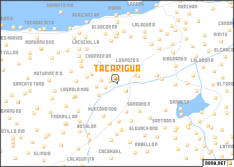
Tacarigua (Sucre, Venezuela)Tacarigua is a town in the Sucre region of Venezuela. An overview map of the region around Tacarigua is displayed below.
regional and 3d topo map of Tacarigua, Venezuela ::
Tacarigua airports ::
The nearest airport is CUM - Cumana Antonio Jose De Sucre, located 46.0 km west of Tacarigua.
Other airports nearby include CUP - Carupano General Jose Francisco Bermudez (59.9 km north east), PMV - Porlamar Del Caribe Intl Gen Santiago Marino (66.6 km north west), MUN - Maturin (92.0 km south east), BLA - Barcelona General Jose Antonio Anzoategui Intl (110.0 km west), Nearby towns ::
El Tigre (1.1km west) //
El Augustín (1.8km south east) //
Cascajal (1.8km north west) //
Los Pozos (1.9km west) //
El Agustín (1.9km south east) //
El Carmen (2.5km west) //
Santa Bárbara (2.7km north west) //
Los Pozos (3.2km north east) //
El Cantón (3.2km north east) //
Jenjibral (3.3km west) //
Maurate (3.4km south west) //
San Juan de Cotúa (3.5km east) //
Los Mangos (3.7km north east) //
El Caituco (4.2km west) //
Chorrerón (4.3km north west) //
El Charal (4.7km south) //
El Picacho (4.9km west) //
Hueco Hondo (5.6km south west) //
San Ramón (5.7km south east) //
La Sabana (6.1km south) //
Paradero (6.3km north west) //
La Vega (6.4km south) //
Limonar Adentro (6.4km west) //
Quebrada Seca y del Tambor (6.4km east) //
Tierra Blanca (6.6km south) //
Los Riecitos (6.7km north west) //
El Cobastre (6.9km north) //
Las Palomas (6.9km west) //
Los Becerros (7.1km east) //
[all distances 'as the bird flies' and approximate] 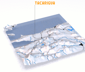 Places with similar names to Tacarigua, Venezuela ::
Disclaimer :: Information on this page comes without warranty of any kind |
||
|
Where is Tacarigua? Elevation and coordinates ::
Latitude (lat): 10°21'49"N Longitude (lon): 63°43'9"W
Elevation (approx.): 248m (map arrows pan, magnifying glasses zoom) |
||
|
Visiting Tacarigua? Hotel/Accommodation ::
Book a hotel in Tacarigua Travel Guide ::
Buy a travel guide for Venezuela rental cars ::
car rental offers GPS waypoint ::
download a GPX waypoint (PoI) of Tacarigua for your GPS receiver
|
||