|
search place name
|
||
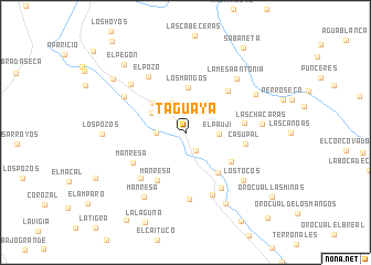
Taguaya (Monagas, Venezuela)Taguaya is a town in the Monagas region of Venezuela. An overview map of the region around Taguaya is displayed below.
regional and 3d topo map of Taguaya, Venezuela ::
Taguaya airports ::
The nearest airport is MUN - Maturin, located 39.7 km south east of Taguaya.
Other airports nearby include CUP - Carupano General Jose Francisco Bermudez (82.1 km north), CUM - Cumana Antonio Jose De Sucre (92.6 km north west), PMV - Porlamar Del Caribe Intl Gen Santiago Marino (120.8 km north west), AAO - Anaco (124.8 km south west), Nearby towns ::
Guayuta (2.1km south east) //
Los Bajos de Aragua (2.9km west) //
La Montaña del Perro (3.2km north west) //
El Paují (3.4km east) //
Los Pozotes (3.9km north west) //
Aragua de Maturín (4.4km north west) //
Los Mangos (4.5km north) //
El Banco de Acosta (5.2km south east) //
El Caño de Los Becerros (5.5km south east) //
Manresa (5.6km south west) //
Rondón (5.9km north east) //
El Culón (5.9km east) //
Manresa (6.1km south west) //
Casupal (6.1km east) //
Sabana Larga (6.4km south west) //
La Soledad (6.6km south east) //
El Pozo (6.8km north west) //
La Orejana (6.8km south) //
El Manguito (6.9km south east) //
El Bajo de Aragua (7.1km north west) //
Buena Vista (7.3km north west) //
La Mesa Antonia (7.5km north east) //
Los Tocos (7.5km south east) //
Manresa (7.7km south west) //
Las Chácaras (7.7km east) //
La Mesa de Punceres (8.0km north east) //
Chaparral (8.3km south east) //
Los Pozos (8.3km west) //
La Batea (9.1km north west) //
[all distances 'as the bird flies' and approximate] 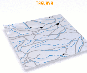 Places with similar names to Taguaya, Venezuela ::
Disclaimer :: Information on this page comes without warranty of any kind |
||
|
Where is Taguaya? Elevation and coordinates ::
Latitude (lat): 9°56'38"N Longitude (lon): 63°27'28"W
Elevation (approx.): 197m (map arrows pan, magnifying glasses zoom) |
||
|
Visiting Taguaya? Hotel/Accommodation ::
Book a hotel in Taguaya Travel Guide ::
Buy a travel guide for Venezuela rental cars ::
car rental offers GPS waypoint ::
download a GPX waypoint (PoI) of Taguaya for your GPS receiver
|
||