|
search place name
|
||
Tignigne (Guárico, Venezuela)Tignigne is a town in the Guárico region of Venezuela. An overview map of the region around Tignigne is displayed below.
regional and 3d topo map of Tignigne, Venezuela ::

Tignigne airports ::
The nearest airport is VLN - Valencia Arturo Michelena Intl, located 100.5 km north west of Tignigne.
Other airports nearby include CCS - Caracas Simon Bolivar Intl (120.5 km north), PBL - Puerto Cabello General Bartolome Salom Intl (137.7 km north west), VDP - Valle De La Pascua (142.0 km east), SFH - San Felipe Sub Teniente Nestor Arias (184.5 km north west), Nearby towns ::
San Juan de Paya (2.8km south east) //
La Caimana (3.5km north west) //
El Negro (4.4km south west) //
Cumbito (4.7km west) //
Dos Caminos (7.1km north west) //
Los Dos Caminos (7.4km north west) //
Veladero (7.9km north west) //
La Encrucijada (8.4km west) //
La Cuesta (8.5km north west) //
Mesa de Paya (9.0km south west) //
Ortiz (9.1km north west) //
[all distances 'as the bird flies' and approximate] 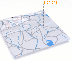 Places with similar names to Tignigne, Venezuela ::
// Dogongan (PH)
// Dogui-ongan (PH)
// Dugoñgan (PH)
// Tagaunggan (MM)
// Dikonguné (BJ)
// Dikonguné (BJ)
// Doukouongon (BJ)
// Digangan (TD)
// Dagangan (ID)
// Takengon (ID)
Disclaimer :: Information on this page comes without warranty of any kind |
||
|
Where is Tignigne? Elevation and coordinates ::
Latitude (lat): 9°32'36"N Longitude (lon): 67°14'44"W
Elevation (approx.): 164m (map arrows pan, magnifying glasses zoom) |
||
|
Visiting Tignigne? Hotel/Accommodation ::
Book a hotel in Tignigne Travel Guide ::
Buy a travel guide for Venezuela rental cars ::
car rental offers GPS waypoint ::
download a GPX waypoint (PoI) of Tignigne for your GPS receiver
|
||