|
search place name
|
||
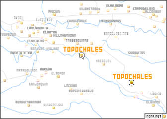
Topochales (Apure, Venezuela)Topochales is a town in the Apure region of Venezuela. An overview map of the region around Topochales is displayed below.
regional and 3d topo map of Topochales, Venezuela ::
Topochales airports ::
The nearest airport is STD - Santo Domingo Mayor Buenaventura Vivas, located 32.7 km west of Topochales.
Other airports nearby include SVZ - San Antonio Del Tachira (86.2 km north west), CUC - Cucuta Camilo Daza (97.9 km north west), LFR - La Fria (103.1 km north west), TME - Tame (111.6 km south), Nearby towns ::
Tres Esquinas (3.8km north) //
Macagua (3.9km north east) //
Isla de Yuca (4.0km north east) //
Macagual (4.7km east) //
Villa Hermosa (6.2km north west) //
El Topón (6.7km south west) //
Vielman (6.9km west) //
La Ceiba (7.2km south) //
El Guamito (7.6km north west) //
Burgüita Abajo (7.9km south) //
Caño Grande (8.0km north) //
Burgua (8.8km west) //
Banco las Piñas (8.9km north east) //
El Hoyon (9.1km north west) //
El Monero (9.4km north west) //
Los Marranos (10.0km north east) //
Guaquitas (11.9km north west) //
[all distances 'as the bird flies' and approximate]  Places with similar names to Topochales, Venezuela ::
// Topochales (VE)
Disclaimer :: Information on this page comes without warranty of any kind |
||
|
Where is Topochales? Elevation and coordinates ::
Latitude (lat): 7°27'36"N Longitude (lon): 71°45'30"W
Elevation (approx.): 199m (map arrows pan, magnifying glasses zoom) |
||
|
Visiting Topochales? Hotel/Accommodation ::
Book a hotel in Topochales Travel Guide ::
Buy a travel guide for Venezuela rental cars ::
car rental offers GPS waypoint ::
download a GPX waypoint (PoI) of Topochales for your GPS receiver
|
||