|
search place name
|
||
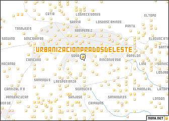
Urbanización Prados del Este (Miranda, Venezuela)Urbanización Prados del Este is a town in the Miranda region of Venezuela. An overview map of the region around Urbanización Prados del Este is displayed below.
regional and 3d topo map of Urbanización Prados del Este, Venezuela ::
Urbanización Prados del Este airports ::
The nearest airport is CCS - Caracas Simon Bolivar Intl, located 20.6 km north west of Urbanización Prados del Este.
Other airports nearby include VLN - Valencia Arturo Michelena Intl (119.2 km west), PBL - Puerto Cabello General Bartolome Salom Intl (130.3 km west), VDP - Valle De La Pascua (167.3 km south east), SFH - San Felipe Sub Teniente Nestor Arias (205.9 km west), Nearby towns ::
El Peñón (0.9km south) //
Curumo (0.9km north) //
Los Campitos (1.5km north) //
La Ciénega (1.8km east) //
Baruta (1.9km south) //
Sosa (1.8km west) //
Maya (2.5km east) //
Las Minas (2.5km east) //
Los Marciales (2.6km north west) //
UrbanizaciónLa Trinidad (2.9km east) //
Piedra Azul (2.9km south) //
Ojo de Agua (3.1km south east) //
Urbanización Valle Arriba (3.3km north east) //
Tucupe Arriba (3.5km south) //
El Respiro (3.7km south) //
La Rinconada (3.6km west) //
Coche (3.6km west) //
Los Jardines (3.6km west) //
El Bertazo (3.6km west) //
El Valle (3.6km west) //
Conejo Blanco (3.6km west) //
Colinas de Santa Monica (3.8km north) //
Colinas de Bello Monte (4.1km north) //
Colinas de Tamanaco (4.1km north east) //
Bermúdez (4.1km south west) //
Urbanización Monterrey (4.1km south east) //
Los Chaguaramos (4.2km north) //
Tucupe del Medio (4.2km south west) //
Lecherito (4.3km south west) //
[all distances 'as the bird flies' and approximate] 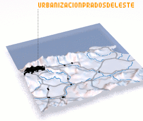 Places with similar names to Urbanización Prados del Este, Venezuela :: Disclaimer :: Information on this page comes without warranty of any kind |
||
|
Where is Urbanización Prados del Este? Elevation and coordinates ::
Latitude (lat): 10°27'0"N Longitude (lon): 66°53'0"W
Elevation (approx.): 929m (map arrows pan, magnifying glasses zoom) |
||
|
Visiting Urbanización Prados del Este? Hotel/Accommodation ::
Book a hotel in Urbanización Prados del Este Travel Guide ::
Buy a travel guide for Venezuela rental cars ::
car rental offers GPS waypoint ::
download a GPX waypoint (PoI) of Urbanización Prados del Este for your GPS receiver
|
||